Brookton, Western Australia
| Brookton Western Australia | |||||||
|---|---|---|---|---|---|---|---|
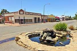 View of Robinson Road, Brookton, 2014 | |||||||
 Brookton | |||||||
| Coordinates | 32°22′05″S 117°00′22″E / 32.368°S 117.006°ECoordinates: 32°22′05″S 117°00′22″E / 32.368°S 117.006°E | ||||||
| Population | 576 (2006 census)[1] | ||||||
| Established | 1890s | ||||||
| Postcode(s) | 6306 | ||||||
| Elevation | 250 m (820 ft) | ||||||
| Location | 138 km (86 mi) ESE of Perth | ||||||
| LGA(s) | Shire of Brookton | ||||||
| State electorate(s) | Wagin | ||||||
| Federal Division(s) | O'Connor | ||||||
| |||||||
Brookton is a town in the Wheatbelt region of Western Australia, 138 kilometres (86 mi) from the state capital, Perth via the Brookton Highway where it crosses the Great Southern Highway. The town is on the Great Southern railway line. It is within, and is the seat of government for, the Shire of Brookton. At the 2006 census, Brookton had a population of 576.[1]
History
The first settler and founder of the Brookton district, John Seabrook (1818–1891), moved to the area in 1846 soon after marrying, and named his property "Brookton House". He remained the only European in the area, aside from itinerant sandalwood cutters, until his stepson, A.W. Robinson, took up adjacent land in 1864. During the 1860s and 1870s, more settlers moved into the area, and took on sandalwood cutting (it sold for £9 per ton) as well as wheat and sheep farming.
In June 1889, when the Great Southern Railway opened, Brookton was one of the original stations. The station proved to be the catalyst that created a centre for the isolated farms, and the government gazetted a townsite here in 1895 and named it "Seabrook" but local acceptance of the station name and confusion with another Seabrook near York resulted in the townsite's name being changed to Brookton in 1899. The townsite attracted a few businesses and by 1903, the tiny settlement comprised a school, hotel, bank and a few shops. The Old Police Station Museum located in the town is the base of the local historical society and contains artifacts and memorabilia of the early settlement days.[2][3][4]
A bulk wheat bin was opened in December 1940 an began receiving large amounts of grain immediately.[5] In 1941 the wheat harvest of the surrounding area was about 90,000 bushels all delived to the local bulk wheat bin. This was about 5,000 bushels down from the previous year.[6]
Present day

Brookton is located on Great Southern Highway, 138 kilometres (86 mi) east of Perth via Brookton Highway and is a key agricultural centre for a rich mixed farming district. In the 2001 census, it reported a population of 576.[7] It contains a TAFE centre, and in addition, a district high school (opened 1960, replacing a primary school), Bendigo Bank, shopping facilities, accommodation (hotel, motel, caravan park), council offices and a telecentre are located within the town. Bi-annually, it hosts the Old Time Motor Show.
The town is a stop on the Transwa bus service to Albany.[8]
Climate
| Climate data for Brookton | |||||||||||||
|---|---|---|---|---|---|---|---|---|---|---|---|---|---|
| Month | Jan | Feb | Mar | Apr | May | Jun | Jul | Aug | Sep | Oct | Nov | Dec | Year |
| Record high °C (°F) | 44.9 (112.8) |
46.2 (115.2) |
41.0 (105.8) |
37.8 (100) |
34.5 (94.1) |
25.0 (77) |
24.0 (75.2) |
26.7 (80.1) |
33.1 (91.6) |
37.1 (98.8) |
41.3 (106.3) |
43.5 (110.3) |
46.2 (115.2) |
| Average high °C (°F) | 32.9 (91.2) |
32.3 (90.1) |
29.5 (85.1) |
25.0 (77) |
20.5 (68.9) |
17.1 (62.8) |
16.1 (61) |
16.8 (62.2) |
19.1 (66.4) |
23.2 (73.8) |
27.4 (81.3) |
31.0 (87.8) |
24.2 (75.6) |
| Average low °C (°F) | 15.5 (59.9) |
16.0 (60.8) |
14.3 (57.7) |
11.2 (52.2) |
7.7 (45.9) |
5.6 (42.1) |
4.5 (40.1) |
4.6 (40.3) |
5.3 (41.5) |
7.4 (45.3) |
11.0 (51.8) |
13.5 (56.3) |
9.7 (49.5) |
| Record low °C (°F) | 7.0 (44.6) |
5.0 (41) |
3.0 (37.4) |
1.1 (34) |
−1.6 (29.1) |
−2.9 (26.8) |
−3.0 (26.6) |
−2.6 (27.3) |
−2.0 (28.4) |
−2.0 (28.4) |
−1.7 (28.9) |
3.0 (37.4) |
−3.0 (26.6) |
| Average precipitation mm (inches) | 12.6 (0.496) |
14.2 (0.559) |
17.9 (0.705) |
25.6 (1.008) |
57.3 (2.256) |
85.5 (3.366) |
85.6 (3.37) |
61.9 (2.437) |
38.9 (1.531) |
25.5 (1.004) |
14.8 (0.583) |
10.3 (0.406) |
449.4 (17.693) |
| Average precipitation days | 2.2 | 2.4 | 3.1 | 5.7 | 10.2 | 14.2 | 15.6 | 13.6 | 10.4 | 7.2 | 4.0 | 2.6 | 91.2 |
| Average relative humidity (%) | 29 | 34 | 37 | 45 | 53 | 62 | 66 | 61 | 55 | 41 | 32 | 28 | 45 |
| Source: [9] | |||||||||||||
References
- 1 2 Australian Bureau of Statistics (25 October 2007). "Brookton (L) (Urban Centre/Locality)". 2006 Census QuickStats. Retrieved 26 June 2011.
- ↑ Western Australian Land Information Authority. "History of country town names – B". Retrieved 25 March 2007.
- ↑ Shire of Brookton. "Shire Profile". Retrieved 14 October 2006.
- ↑ Sydney Morning Herald (28 February 2004). "Travel – Brookton". The Sydney Morning Herald. Retrieved 14 October 2006.
- ↑ "Seasonal conditions". The West Australian. Perth: National Library of Australia. 31 December 1940. p. 9. Retrieved 3 April 2013.
- ↑ "Seasonal conditions". The West Australian. Perth: National Library of Australia. 4 February 1941. p. 4. Retrieved 3 April 2013.
- ↑ Australian Bureau of Statistics (19 November 2002). "Community Profile Series : Brookton (L) (Urban Centre/Locality)". 2001 Census of Population and Housing. Retrieved 25 March 2007.
- ↑ GS2 timetable Archived 28 August 2007 at the Wayback Machine. (1 November 2006). Retrieved on 25 March 2007.
- ↑ "Climate statistics for". Bureau of Meteorology. Retrieved 12 July 2014.
External links
![]() Media related to Brookton, Western Australia at Wikimedia Commons
Media related to Brookton, Western Australia at Wikimedia Commons