Brownsmead, Oregon
| Brownsmead, Oregon | |
|---|---|
| Unincorporated community | |
|
Grange hall | |
 Brownsmead  Brownsmead Location within the state of Oregon | |
| Coordinates: 46°13′3″N 123°32′29″W / 46.21750°N 123.54139°WCoordinates: 46°13′3″N 123°32′29″W / 46.21750°N 123.54139°W | |
| Country | United States |
| State | Oregon |
| County | Clatsop |
| Time zone | Pacific (PST) (UTC-8) |
| • Summer (DST) | PDT (UTC-7) |
| ZIP code | 97103 |
| Area code(s) | 503 and 971 |
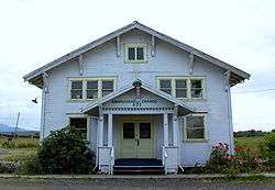
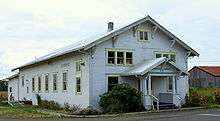
Grange hall
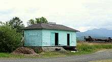
Rail station
Brownsmead is an unincorporated community, on a distributary of the Columbia River called Saspal Slough, in Clatsop County, Oregon. Previously known as Brody, it was named after W.G. Brown, a Portland engineer involved in land reclamation in the area. There was a post office in Brownsmead from 1919 to 1975,[1] located in the Brownsmead General Store.
Historic photos of the Brownsmead fish station, located where Davis Creek feeds into Blind Slough, reveal docked gillnetting boats. One such boat is shown in the boat hoist, resting above the water by several feet on the dock.[2]
Brownsmead is the northernmost settlement in the state of Oregon.
References
- ↑ McArthur, Lewis A.; McArthur, Lewis L. (2003) [1928]. Oregon Geographic Names (7th ed.). Portland, Oregon: Oregon Historical Society Press. p. 118. ISBN 978-0875952772.
- ↑ Historic Photographs of Brownsmead salmon station
Municipalities and communities of Clatsop County, Oregon, United States | ||
|---|---|---|
| Cities | 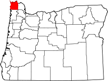 | |
| CDPs | ||
| Other unincorporated communities | ||
This article is issued from Wikipedia - version of the 11/9/2016. The text is available under the Creative Commons Attribution/Share Alike but additional terms may apply for the media files.