Buldhana
This article is about the city. For the district of which it is the headquarters, see Buldhana district.
| Buldhana district बुलढाणा जिल्हा | |
|---|---|
| District of Maharashtra | |
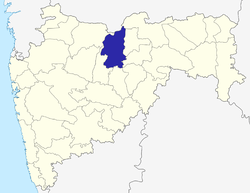 Location of Buldhana district in Maharashtra | |
| Country | India |
| State | Maharashtra |
| Administrative division | Amravati Division |
| Headquarters | Buldhana |
| Tehsils | Buldhana, Chikhli, Deulgaon Raja, Khamgaon, Shegaon, Malkapur, Motala, Nandura, Mehkar, Lonar, Sindkhed Raja, Jalgaon Jamod, Sangrampur |
| Government | |
| • Lok Sabha constituencies | Buldhana (MH-5), Raver (MH-4)( shared with Jalgaon district ) [1] |
| • Assembly seats | Malkapur, Buldhana, Chikhli, Sindkhed Raja, Mehkar, Khamgaon, Jalgaon Jamod |
| Area | |
| • Total | 9,640 km2 (3,720 sq mi) |
| Population | |
| • Total | 67,431 |
| • Density | 7.0/km2 (18/sq mi) |
| Demographics | |
| • Literacy | 82.09% |
| • Sex ratio | 928 |
| Major highways | NH-6 |
| Website | Official website |
Buldhana is the district headquarters and a Municipal Council in the Buldhana District of Amravati division in the Indian State of Maharashtra. It is situated at the westernmost border of the Vidarbha region of Maharashtra and is 500 km from the state capital, Mumbai.
Demographics
As of 2011 India census,[2] Buldana city had a population of 67,431. Males constitute 52% of the population and females 48%.Buldana has an average literacy rate of 82%, higher than the national average of 59.5%; with male literacy of 82% and female literacy of 72%. 13% of the population is under 6 years of age.
Buldhana District News Portals
- Buldhana Today "Buldhana Today".
See also
References
| Wikivoyage has a travel guide for Buldhana. |
| Wikisource has original text related to this article: |
- ↑ Election Commission website Archived March 6, 2009, at the Wayback Machine.
- ↑ "Census of India 2011: Data from the 2011 Census, including cities, villages and towns (Provisional)". Census Commission of India. Archived from the original on 2004-06-16. Retrieved 2008-11-01.
 |
Motala, Malkapur | Khamgaon | | |
| Ajanta Caves, Aurangabad | |
Undri | ||
| ||||
| | ||||
| Bhokardan | Chikhli |
| Subdivisions and tehsils | | |
|---|---|---|
| Cities, towns and villages | ||
| Railway stations |
| |
| Roads | ||
| Historical |
| |
| Geography | ||
| Lok Sabha constituencies | ||
| Vidhan Sabha constituencies |
| |
| Religious | ||
| People |
| |
| See Also |
| |
Coordinates: 20°31′58″N 76°10′58″E / 20.53278°N 76.18278°E
This article is issued from Wikipedia - version of the 11/18/2016. The text is available under the Creative Commons Attribution/Share Alike but additional terms may apply for the media files.