Burwood Heights, New South Wales
| Burwood Heights Sydney, New South Wales | |||||||||||||
|---|---|---|---|---|---|---|---|---|---|---|---|---|---|
 Federation house on Liverpool Road | |||||||||||||
| Population | 810 (2011 census)[1] | ||||||||||||
| • Density | 2,700/km2 (7,000/sq mi) | ||||||||||||
| Postcode(s) | 2136 | ||||||||||||
| Area | 0.3 km2 (0.1 sq mi) | ||||||||||||
| Location | 12 km (7 mi) from Sydney CBD | ||||||||||||
| LGA(s) | Burwood Council | ||||||||||||
| State electorate(s) | Strathfield | ||||||||||||
| Federal Division(s) | Watson | ||||||||||||
| |||||||||||||
Burwood Heights is a suburb in the Inner West[2] of Sydney, in the state of New South Wales, Australia. It is located 12 kilometres west of the Sydney central business district and is situated within the local government area of Burwood Council.
Burwood Heights is a residential suburb with no shops, schools or any public buildings. The postcode is 2136, the same as neighbouring Enfield. Burwood is a separate suburb, to the north.
History
The Geographical Names Board of New South Wales assigned Burwood Heights the status of a separate suburb on 19 January 2007.[3]
Population
According to the 2011 census of Population, there were 810 residents in Burwood Heights. In Burwood Heights, 57.8% of people were born in Australia. The most common countries of birth were Italy 9.3%, China (excludes SARs and Taiwan) 5.3%, Greece 2.7%, Vietnam 2.2% and England 2.0%. 48.3% of people only spoke English at home. Other languages spoken at home included Italian 13.9%, Greek 7.4%, Arabic 5.6%, Mandarin 4.7% and Korean 2.2%. The most common responses for religion in Burwood Heights (State Suburbs) were Catholic 39.2%, No Religion 13.9% and Eastern Orthodox 9.8%. [1]
-

-
-

-
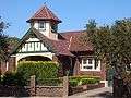
Possibly 70 Burwood Road Burwood Heights
-

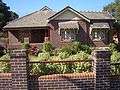
72 Liverpool Road Burwood Heights
-
74 Liverpool Road Burwood Heights
-

78 Liverpool Road Burwood Heights
-

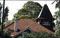
78 Liverpool Road side view Burwood Heights
-

92 Liverpool Road Burwood Heights
-
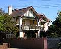
92 Liverpool Road Burwood Heights
References
- 1 2 Australian Bureau of Statistics (31 October 2012). "Burwood Heights (State Suburb)". 2011 Census QuickStats. Retrieved 29 April 2013.
- ↑ Australian Suburb Guide: Sydney Inner West Archived 26 December 2012 at the Wayback Machine. Retrieved 7 August 2013.
- ↑ "Geographical Names Board Register". Retrieved 4 April 2014.
Coordinates: 33°53′25″S 151°06′19″E / 33.8902°S 151.1052°E