Bylas, Arizona
| Bylas, Arizona | |
|---|---|
| Census-designated place | |
 Bylas  Bylas | |
| Coordinates: 33°8′19″N 110°7′30″W / 33.13861°N 110.12500°WCoordinates: 33°8′19″N 110°7′30″W / 33.13861°N 110.12500°W | |
| Country | United States |
| State | Arizona |
| County | Graham |
| Indian Reservation | San Carlos Apache Indian Reservation |
| Area[1] | |
| • Total | 4.404 sq mi (11.41 km2) |
| • Land | 4.384 sq mi (11.35 km2) |
| • Water | 0.020 sq mi (0.05 km2) |
| Elevation[2] | 2,608 ft (795 m) |
| Population (2010)[3] | |
| • Total | 1,962 |
| • Density | 450/sq mi (170/km2) |
| Time zone | Mountain (MST) (UTC-7) |
Bylas is an unincorporated community and census-designated place in Graham County, Arizona, United States, within the San Carlos Apache Indian Reservation. As of the 2010 census, its population was 1,962.[3] The community has a medical clinic, a police substation, and a market. Bylas is an Apache settlement divided into two communities, one of the White Mountain Apache, the other of San Carlos and Southern Tonto Apache. It ist named for Bylas (aka Bailish) an chief of the Eastern White Mountain Apache band.
Geography
Bylas is located at 33°8′19″N 110°7′30″W / 33.13861°N 110.12500°W (33.1386688, -110.1250875), at an elevation of 2,608 feet (795 m).[2]
People
- Chesley Goseyun Wilson, Apache fiddle maker and player, National Heritage Award winner (1989)
See also
Climate
According to the Köppen Climate Classification system, Bylas has a semi-arid climate, abbreviated "BSk" on climate maps.[4]
References
- ↑ "US Gazetteer files: 2010, 2000, and 1990". United States Census Bureau. 2011-02-12. Retrieved 2011-04-23.
- 1 2 U.S. Geological Survey Geographic Names Information System: Bylas, Arizona
- 1 2 "American FactFinder". United States Census Bureau. Retrieved 2011-05-14.
- ↑ Climate Summary for Bylas, Arizona
External links
Municipalities and communities of Graham County, Arizona, United States | ||
|---|---|---|
| City | 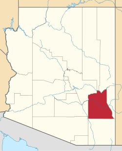 | |
| Towns | ||
| CDPs | ||
| Unincorporated communities | ||
| Indian reservations | ||
| Ghost towns | ||
| Footnotes | ‡This populated place also has portions in an adjacent county or counties | |