Cárdenas, San Luis Potosí
| City of Cárdenas Ciudad de Cárdenas | |
|---|---|
| city | |
|
Central Cárdenas | |
| Nickname(s): La ciudad del ferrocarril (The rail city) | |
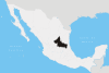
| Country | Mexico |
| State | San Luis Potosí |
| Founded | 17th century |
| Government | |
| • Mayor |
José Luis Montaño Chávez( |
| Elevation | 9 m (30 ft) |
| Population (2005) | |
| • Total | 20,000 |
| Time zone | Central Standard Time (UTC-6) |
| • Summer (DST) | Central Daylight Time (UTC-5) |
| Website | www.cárdenaslp.gob.mx |

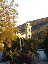
Cárdenas is a municipality and city in the Mexican state of San Luis Potosí.
The municipality is located east of the state capital in the Media Zone, the municipality has the following coordinates: 99 ° 39 'W and 22 ° 00' north, with a height of 1.200 m above sea level. It is bordered to the north with Alaquines, East Tamasopo, South Rayon, West Río Verde, and 200 km from the city of San Luis Potosí with a population of about 20.000 inhabitants is the second largest city in the Media Zone. it is 19 km away from the town of Alaquines, San Luis Potosí.
History
The first settlers were the friars, who occupied the ground in the first third of the seventeenth century, they occupied rancherías and farms, including the huge Ciénega de San Nicolás, allegedly founded by Luis de Cardenas.
In those years referred to as the Ciénega Nicholi and the name of his owner was called after Hacienda de Cárdenas.
Origin of the city
For more than a century it was owned by the Bacon family. Throughout that time, and years later there was a rise in its population in those that had families of all castes, but most were pames and few spoke Spanish, were not concentrated in one locale but in several rancherías dispersed, and one or two friars of the mission of Alaquines served as religious.
In the year of 2752 finances of the Ciénega was owned by Don Manuel Antonio Rojo del Río, Lafuente and Vieyra. By be confiscated and purchased their property, they came to power by Félix María Calleja and then Don Felipe Barragan. Upon the death of the latter was that property held by their children and Luisa Juan Barragan. At come up war of the Mexican Independence, there were several facts weapons on the territory of the finances of Cardenas. It is mentioned in various fighting forces commanded realistic Don Cayetano Quintero and don Felipe de la Garza and guerrilla insurgents Desiderio Zarate
The Railway in Cardenas

In 1933 became one of the projects form town as one of the most modern state, rail, the project would include the construction of the railway San Luis Potosí -- Tampico; the work progressed slowly, both in the extreme as potosino from Tampico. There were subsequent interruptions, contracts unfulfilled, insufficient funds, court trouble.
In these works had to overcome the difficulties presented by the laying of the road since Tamasopo until Highland Potosino built several tunnels, penetrating mountains. This bold work that defied saw, finally found the paths ahead of the current population of Cardenas, in the Labor, April 1890.
Since then became totally life in Cardenas; soon settled workshops of the Cardenas Division. He grew population, was founded neighborhood Rasconcito, and Colonia Americana, was activated remarkably trade with the influx of many families who came from Alaquines, Rayon, Lagunillas and other more distant locations, it was a time euphoric that desbordaba joyful in all areas of the region. This situation lasted until 1910.
By the beginning of the year, 1911 Cárdenas was heard in the first outbreaks revolutionaries led by Higinio Olivo, a native of The Work and Juan Torres Perez, up arms in El Corito. The forces of Peter Montoya and brothers Juan and Cardenas Victorian Torres entered in 1911. In 1912 brothers Cedillo, Magdaleno, Saturnino Cleofas and began a series of tropelías in open rebellion against President Francisco I. Madero.
In 1914 cedillistas were posesionados de Cardenas, it had established its headquarters and committed all kinds of abuses. It seized the station and the trains and cargo.
The most important battle in Cardenas recorded during the Mexican Revolution, was developed May 27, 1917. The square was defended by a garrison commanded by Colonel Fidel Garza and the captains first Ramon Hernandez and Margarito Negrete when he was violently attacked by forces cedillistas. The fighting spread to the entire population, the attackers took installations of the railways, burned the tank chapopote and the scale and tried to burn down the station.
Notable Residents
- E. Blas Rodriguez (1880-1949) Author of important studies on history and archaeology huasteca and legal studies.
- Jesus Maria Colunga (1845-1891) He received the priesthood in 1871 served in several curatos.
- Higinio Olivo (-1915) Revolutionary Carrancista joined forces Cedillo, but in 1912 he was separated from joining other revolutionaries constitutionalists like Juan Barragan and Jesus Agustin Castro reaching the rank of colonel, was taken prisoner by being villistas shot in March 1915.
- Miguel Angel Herrera (1932-2006) He published his interesting book "Cardenas my memories." Friend of several newspapers and magazines. Partner of the Academia Historica Potosina author Shield Officer Cardenas. Chronicler of the National Association of Cardenenses Potosinos. It won the prize for history Francisco Pena "in November 1984.
- ldelfonso Turrubiartes (1890-1963) In 1911 he joined the forces of the brothers Cedillo. After the Revolution was head of a Cologne Agricultural Military and 1925 was promoted to Brigadier General. Governor of the State of San Luis Potosi over the years, 1931 1935, and for its management was given autonomy of the University. He died on March 1.
- Fernando Z. Maldonado () Illustrious composer of this city, one of their more reelevantes and better known by all "Volver, Volver" to make the famous author Vicente Fernandez, "not keep crying", "looks like", "Love in the street," are others of his great compositions, killed along with his wife Eglatina Covarruvias at his home in Cuernavaca, Morelos.
Geography
Extension of Cárdenas
According to the Integrated System and Geographic Information Statistics INEGI, 2000, the total area of the municipality is 384.26 km2 and accounts for 0.63% of the state territory.
Orography
It is located formations mountainous as the Sierra de Santa Gertrudis,sierra Paredes, El Picacho, El Azafrán, Catana y El Grande.
Climate
The average annual rainfall is recorded 616.6 mm (24.28 in), and dominates much of the region west of the semi-dry-weather semi-warm center, semi-warm and humid east semicálido-wet with rain in the summer. Its average annual temperature is 26.9 °C, reaching a maximum at summer of 47 degrees Celsius and a minimum winter 5 degrees Celsius.
Mayors of Cárdenas
Mayors - Period of Government
- José García Ramos 1951-1952
- Melquiades Castillo. 1953-1955
- Felipe Castillo Vega. 1956-1958
- J. Trinidad García Ramos. 1959-1961
- René Castillo Vega. 1962-1964
- Enrique Palau Zuñiga. 1965-1967
- Carlos Guzmán. 1968-1970
- Jaime Rodríguez Lara. 1971-1973
- José López Rubio. 1974-1976
- Enrique Zubiaga Ramírez. 1977-1979
- René Castillo Vega. 1980-1982
- Ernesto Torres Alvarado. 1983-1985
- Indalecio Medina Calderón. 1986-1988
- Amonario Díaz de León. 1992-1994
- Arturo Hernández Maltus. 1995-1997
- Nicolás Torres Torres. 1997-2000
- Jaime Macías Oviedo 2000-2003
- Agustín Pérez Gómez 2004-2006
- José Luis Montaño Chávez 2006–Present
References
- H. Ayuntamiento de Cárdenas, S.L.P.
- Instituto Nacional de Estadística Geografía e Informática, XII Censo General de Población y Vivienda 2000, Tabulados Básicos, San Luis Potosí, Workshops Graphics of INEGI, Aguascalientes, marzo del 2001.
- Pedraza Montes José Francisco, History of the city of Cárdenas from the state of San Luis Potosí, Centre for Municipal Development, 1994
Cities Surrounding Cárdenas
External links
- La población de los municipios de México 1950-1990, UNO servicios gráficos, México, 1994
- Gobierno del estado de San Luis Potosí
- Centro Nacional de Estudios Municipales, Gobierno del Estado de San Luis Potosí, Los Municipios de San Luis Potosí, en “Colección: Enciclopedia de los Municipios de México”, Talleres Gráficos de la Nación, México, 1987
- Instituto Nacional de Estadística, Geografía e Informática
Coordinates: 22°00′36″N 99°39′07″W / 22.010°N 99.652°W