Cabo Corrientes
Not to be confused with Cape/Cabo Corrientes, the second westernmost point of the island of Cuba (21°26′N 84°18′W / 21.43°N 84.30°W).
Coordinates: 20°24′32″N 105°41′40″W / 20.40889°N 105.69444°W
| Cabo Corrientes | |
|---|---|
| Municipality and town | |
 | |
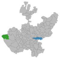
 Municipality location in Jalisco | |
 Cabo Corrientes Location in Mexico | |
| Coordinates: 20°24′32″N 105°41′40″W / 20.40889°N 105.69444°W | |
| Country |
|
| State | Jalisco |
| Area | |
| • Total | 2,001.6 km2 (772.8 sq mi) |
| Population (2005) | |
| • Total | 9,034 |
| Time zone | CST (UTC-6) |
| • Summer (DST) | CDT (UTC-5) |
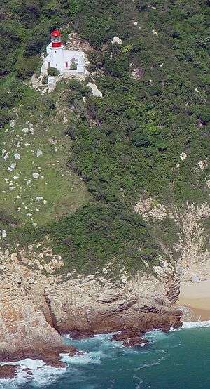
Cabo Corrientes is a cape on the Pacific coast of the Mexican state of Jalisco. It marks the southernmost point of the Bahía de Banderas (Bay of Flags), upon which the port and resort city of Puerto Vallarta stands. The municipality in which the cape lies is also called Cabo Corrientes.
Cabo Corrientes is a prominent navigational landmark, featured on the earliest cartography of the region. Cruising sailors often refer to it as Mexico's Point Conception.
Notes
- ^ "Cruiser Lost on the Gold Coast of Mexico". Retrieved 2007-09-30.
- ^ "Slackers in Paradise: Heading North". Retrieved 2007-09-30.
This article is issued from Wikipedia - version of the 2/19/2016. The text is available under the Creative Commons Attribution/Share Alike but additional terms may apply for the media files.
