Camillus, New York
| Camillus, New York | |
|---|---|
| Town | |
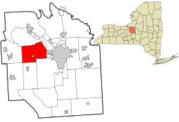 Location in Onondaga County and the state of New York. | |
| Coordinates: 43°02′33″N 76°15′39″W / 43.04250°N 76.26083°WCoordinates: 43°02′33″N 76°15′39″W / 43.04250°N 76.26083°W | |
| Country | United States |
| State | New York |
| County | Onondaga |
| Government | |
| • Type | Town Council |
| • Town Supervisor | Mary Ann Coogan (R) |
| • Town Council |
Members
|
| Area | |
| • Total | 34.5 sq mi (89.3 km2) |
| • Land | 34.5 sq mi (89.3 km2) |
| Population (2010) | |
| • Total | 24,167 |
| • Density | 700/sq mi (270/km2) |
| Time zone | Eastern (EST) (UTC-5) |
| • Summer (DST) | EDT (UTC-4) |
| ZIP codes | 13031 |
| Area code(s) | 315 |

Camillus is a town in Onondaga County, New York, United States. The population was 24,167 at the 2010 census.[1] The town was named after Roman military leader Marcus Furius Camillus by a clerk interested in the classics.
The Town of Camillus is west of Syracuse. There is also a village named Camillus in the town. Much of the town is a western suburb of Syracuse.
Geography
According to the United States Census Bureau, the town has a total area of 34.5 square miles (89.3 km²), all of it land.
New York State Route 5 is an east-west highway across the town. New York State Route 173 intersects NY-5 near Fairmount. New York State Route 174 intersect NY-5 near Camillus village. New York State Route 321 intersects NY-5 at Bennetts Corners. New York State Route 695 and New York State Route 297 are state highways near the east town line.
History
Camillus was part of the former Central New York Military Tract. Joseph Sherwood, the first pioneer arrived around 1795 at the site of the village of Camillus. The Town of Camillus was formed in 1799 with land from the Town of Marcellus. Industrial development was promoted by the Erie Canal in 1825. Camillus was also on the railroad line linking Syracuse to Auburn in 1838. The Nine Mile Creek Aqueduct and Wilcox Octagon House are listed on the National Register of Historic Places.[2]
Demographics
| Historical population | |||
|---|---|---|---|
| Census | Pop. | %± | |
| 1820 | 5,791 | — | |
| 1830 | 2,518 | −56.5% | |
| 1840 | 3,957 | 57.1% | |
| 1850 | 3,105 | −21.5% | |
| 1860 | 2,940 | −5.3% | |
| 1870 | 2,423 | −17.6% | |
| 1880 | 2,416 | −0.3% | |
| 1890 | 2,678 | 10.8% | |
| 1900 | 2,453 | −8.4% | |
| 1910 | 2,642 | 7.7% | |
| 1920 | 2,905 | 10.0% | |
| 1930 | 4,066 | 40.0% | |
| 1940 | 4,394 | 8.1% | |
| 1950 | 6,735 | 53.3% | |
| 1960 | 18,328 | 172.1% | |
| 1970 | 26,841 | 46.4% | |
| 1980 | 24,333 | −9.3% | |
| 1990 | 23,625 | −2.9% | |
| 2000 | 23,152 | −2.0% | |
| 2010 | 24,167 | 4.4% | |
| Est. 2014 | 24,285 | [3] | 0.5% |
As of the census[5] of 2000, there were 23,152 people, 9,315 households, and 6,595 families residing in the town. The population density was 671.9 people per square mile (259.4/km²). There were 9,661 housing units at an average density of 280.4 per square mile (108.2/km²). The racial makeup of the town was 96.45% White, 0.95% Black or African American, 0.37% Native American, 1.10% Asian, 0.02% Pacific Islander, 0.27% from other races, and 0.84% from two or more races. Hispanic or Latino of any race were 0.92% of the population.
There were 9,315 households out of which 30.5% had children under the age of 18 living with them, 58.1% were married couples living together, 9.8% had a female householder with no husband present, and 29.2% were non-families. 25.1% of all households were made up of individuals and 12.0% had someone living alone who was 65 years of age or older. The average household size was 2.48 and the average family size was 2.99.
In the town the population was spread out with 24.2% under the age of 18, 5.8% from 18 to 24, 27.5% from 25 to 44, 24.2% from 45 to 64, and 18.3% who were 65 years of age or older. The median age was 40 years. For every 100 females there were 91.3 males. For every 100 females age 18 and over, there were 87.3 males.
The median income for a household in the town was $50,198, and the median income for a family was $58,395. Males had a median income of $41,011 versus $29,110 for females. The per capita income for the town was $22,591. About 3.1% of families and 4.3% of the population were below the poverty line, including 5.6% of those under age 18 and 4.6% of those age 65 or over.
 Lowe’s in Camillus
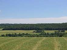
 An upscale home nestled in the western hills of Camillus.
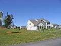 Housing development
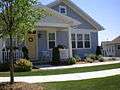 Annesgrove Traditional Neighborhood in Camillus
 St Joseph's Catholic Church
Communities and locations in the Town of Camillus
- Amboy – A hamlet in the north central part of Camillus on NY-173.
- Amboy Station – A location north of Amboy.
- Belle Isle – A location east of Amboy and adjacent to Rt. 695 and the NYS Fairgrounds.
- Bennetts Corners – A hamlet near the west town line by the junction of NY-5 and NY-321.
- Camillus – The Village of Camillus is in the southwest part of the Town of Camillus.
- Camillus Airport (NY2) – A small general aviation airport near the north town line, about a mile from the former Syracuse Municipal Airport.
- Daniluk Drive – A neighborhood near the west town line by the junction of NY-5.
- 'Edgewood Garden'a – A neighborhood near the north town line.
- Fairmount – A hamlet near the east town line.
- Four Winds – A group of homes located in the Hamlet of Newport
- Fox Chapel – A neighborhood approximately 5 minutes from the village of Camillus.
- Garden Terrace – A neighborhood near the north town line.
- Greenfield Village – A neighborhood adjacent to Amboy and across from Reed Webster park.
- Hidden Knolls – A neighborhood just west of Fairmount, on a hill above Shove Park.
- Memphis – A hamlet at the north town line north of Oswego Bitters.
- Newport – A hamlet near the north town line.
- Ninemile Creek – A Stream flowing through the western part of the town.
- North Belle Isle – A hamlet near the east town line.
- Orchard Village – A neighborhood near the south town line.
- Oswego Bitters – A hamlet in the western part of the town on Bitters Road, west of Bennetts Corners Road.
- Parson Farms – A neighborhood near the south town line.
- Pioneer Farms – A neighborhood west of the Weatheridge and Fox Chapel neighborhoods and across from the Camillus Medical Center (formerly the GTE building).
- Scenic Hills – A neighborhood on the south town line between Kasson Road and Westvale Golf Course.
- Sherwood Knolls – A neighborhood near the south town line.
- Stanley Manor – A neighborhood near the south town line.
- Syracuse Municipal Airport – A former airport in the northeast part of the town. It was an early center for aviation in the county.
- Warners – A hamlet at the north town line, north of Newport.
- Weatheridge – A neighborhood southeast of Camillus village bordering Pioneer Farms
- Wellington – A neighborhood along NYS Route 5.
- Westerlea – A neighborhood northeast of Camillus village.
- Westview Manor – A neighborhood east of Camillus village.
- West Genesee Terrace – A neighborhood east of Camillus village.
- Wincrest Park – A neighborhood southeast of Camillus village.
Notable people
- Kinsley S. Bingham, politician
- Kelly Cutrone, American fashion publicist
- Frank DiPino, Major League pitcher
- John Katko, politician
- Francis Paddock, politician
- Susan Wynne, American ice dancer
See also
References
- ↑ "American FactFinder". United States Census Bureau. Archived from the original on 2013-09-11. Retrieved 2011-05-14.
- ↑ National Park Service (2009-03-13). "National Register Information System". National Register of Historic Places. National Park Service.
- ↑ "Annual Estimates of the Resident Population for Incorporated Places: April 1, 2010 to July 1, 2014". Retrieved June 4, 2015.
- ↑ "Census of Population and Housing". Census.gov. Archived from the original on May 11, 2015. Retrieved June 4, 2015.
- ↑ "American FactFinder". United States Census Bureau. Archived from the original on 2013-09-11. Retrieved 2008-01-31.
External links
| Wikimedia Commons has media related to Camillus, New York. |
- Town of Camillus official site
- Camillus history/genalogy links
- The Eagle Observer - Weekly Newspaper
Municipalities and communities of Onondaga County, New York, United States | ||
|---|---|---|
| City | 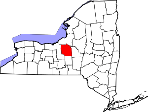 | |
| Towns | ||
| Villages | ||
| CDPs | ||
| Other hamlets |
| |
| Indian reservation | ||
| Footnotes | ‡This populated place also has portions in an adjacent county or counties | |