Camp Edwards Heliport
| Camp Edwards Heliport | |||||||||||
|---|---|---|---|---|---|---|---|---|---|---|---|
| IATA: none – ICAO: none – FAA LID: MA29 | |||||||||||
| Summary | |||||||||||
| Airport type | Private | ||||||||||
| Owner | Massachusetts Army National Guard / U.S. Army | ||||||||||
| Location | Camp Edwards / Bourne, Massachusetts | ||||||||||
| In use | 19??-Present | ||||||||||
| Elevation AMSL | 135 ft / 41 m | ||||||||||
| Coordinates | 41°40′17″N 070°33′53″W / 41.67139°N 70.56472°W | ||||||||||
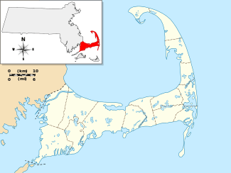
| Map | |||||||||||
 MA29 | |||||||||||
| Helipads | |||||||||||
| |||||||||||
| Statistics | |||||||||||
| |||||||||||
Camp Edwards Heliport (FAA LID: MA29) is a private use heliport located at Camp Edwards, a U.S. Army facility in Barnstable County, Massachusetts, United States. The airport is located three nautical miles (6 km) north of the central business district of Bourne, Massachusetts. It is owned by the Massachusetts Army National Guard.[1]
Facilities and aircraft
Camp Edwards Heliport has one helipad designated H1 with a concrete surface measuring 117 by 40 feet (36 x 12 m). There are 17 helicopters based at this facility.[1]
References
External links
- Aerial image as of March 1995 from USGS The National Map
- Resources for this airport:
- FAA airport information for MA29
- AirNav airport information for MA29
- FlightAware airport information and live flight tracker
- SkyVector aeronautical chart for MA29
This article is issued from Wikipedia - version of the 11/27/2015. The text is available under the Creative Commons Attribution/Share Alike but additional terms may apply for the media files.
