Carsphairn

Carsphairn (Gaelic: An Còrsa Feàrna) is a village in Dumfries and Galloway, Scotland. It is located about halfway between Dalmellington and St. John's Town of Dalry, on the A713 road. Carsphairn annual sheep show is held in the village. Cairnsmore of Carsphairn is to the north east of the village in the Carsphairn and Scaur Hills. To the west is the ridge of the Rhinns of Kells[1] in the Galloway Hills.
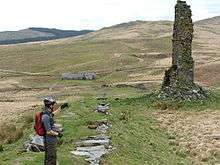
The village has many features ranging from an ancient stone circle[2] to a nuclear listening post[3] (now disused), and includes local amenities such as a shop, tearoom, a primary school and a village hall.
History
Carsphairn was made an independent parish around 1627,[4] prior to which it had been a part of the Parish of Dalry, and was created a Free Burgh in 1672 under a charter requested by Robert Grierson of Lag.[5]
Industry
Industry is mainly rural, but, historically, a significant mining industry existed, particularly of lead, following the discovery of significant quantities in 1837. By the mid 1850s the mine was producing 1000 tons annually.[6] Mining continued in the area, with peak production between 1906-1914. Following the end of the First World War, the industry collapsed and by 1928 all lead mining operations had ceased.[7]
List of listed buildings
List of listed buildings in Carsphairn, Dumfries and Galloway
References
- ↑ map of the Rhinns of Kells with hill walking routes
- ↑ Holm of Daltallochan stone circle
- ↑ Royal Observer Corps database of UK monitoring posts
- ↑ Great Britain. Parliament. House of Lords (1841) "Sessional Papers Printed by Order of the House of Lords, Or Presented by Royal Command, in the Session 40 & 50 Victoriæ (26th January-22d June) and the Session 50 Victoriæ (19th August-7th October) 1841", Volume 7, P190 Retrieved May 2013
- ↑ Ed. John Nicholson (1855) "Minute book kept by the war committee of the Covenanters in the stewartry of Kircudbright ... 1640 and 1641",[sic, Spelling] P179, Kirkcudbright county. Retrieved May 2013
- ↑ Royal Scottish Society of Arts (1851) "Transactions of the Royal Scottish Society of Arts", Volume 3, P21., Neill & Company. Retrieved May 2013
- ↑ Payne, P.L. (1967) "Studies in Scottish business history", P107, Routledge, ISBN 0714613495 Retrieved May 2013
External links
| Wikimedia Commons has media related to Carsphairn. |
Coordinates: 55°12′37″N 4°15′53″W / 55.21019°N 4.26463°W