Catlett, Virginia
| Catlett, Virginia | |
|---|---|
| Census-designated place | |
|
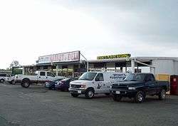
Catlett Deli | |
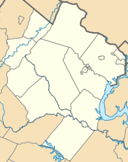 Catlett  Catlett  Catlett Location within Fauquier county | |
| Coordinates: 38°39′13″N 77°38′26″W / 38.65361°N 77.64056°WCoordinates: 38°39′13″N 77°38′26″W / 38.65361°N 77.64056°W | |
| Country | United States |
| State | Virginia |
| County | Fauquier |
| Area | |
| • Total | 3.24 sq mi (8.40 km2) |
| • Land | 3.22 sq mi (8.33 km2) |
| • Water | 0.03 sq mi (0.07 km2) |
| Elevation | 270 ft (80 m) |
| Population (2010) | |
| • Total | 296 |
| • Density | 92/sq mi (35.5/km2) |
| Time zone | Eastern (EST) (UTC-5) |
| • Summer (DST) | EDT (UTC-4) |
| ZIP code | 20119 |
| FIPS code | 51-13624 |
| GNIS feature ID | 1492729 |
Catlett is a census-designated place (CDP) in Fauquier County, Virginia, United States. The population as of the 2010 census was 296.[1] It is located west of the Prince William County line. Catlett was a former rail stop on the Orange and Alexandria Railroad. The area was the site of many raids on the railroad during the American Civil War. Today, it is a small community.
The Catlett Historic District was listed on the National Register of Historic Places in 2008, and Auburn Battlefield in 2011.[2][3]
Geography
Catlett is located in southeastern Fauquier County, bordered to the southwest by Calverton. Virginia State Route 28 passes through the community, leading southwest through Calverton to Midland and Bealeton; to the northeast it leads through Nokesville in Prince William County to the city of Manassas. Warrenton, the Fauquier County seat, is 12 miles (19 km) to the northwest via local roads.
According to the U.S. Census Bureau, the Catlett CDP has a total area of 3.2 square miles (8.4 km2), of which 0.03 square miles (0.07 km2), or 0.84%, is water.[1] The western and southern edge of Catlett is formed by Cedar Run, a tributary of the Occoquan River, which flows southeast to the Potomac.
Education
Catlett contains H. M. Pearson Elementary School.[4]
References
- 1 2 "Geographic Identifiers: 2010 Demographic Profile Data (G001): Catlett CDP, Virginia". U.S. Census Bureau, American Factfinder. Retrieved October 18, 2016.
- ↑ National Park Service (2010-07-09). "National Register Information System". National Register of Historic Places. National Park Service.
- ↑ "National Register of Historic Places Listings". Weekly List of Actions Taken on Properties: 8/09/10 through 8/13/10. National Park Service. 2011-12-23.
- ↑ http://www.fcps1.org/education/school/school.php?sectionid=19
- Virginia Trend Report 2: State and Complete Places (Sub-state 2010 Census Data)
- U.S. Geological Survey Geographic Names Information System: Catlett, Virginia
Municipalities and communities of Fauquier County, Virginia, United States | ||
|---|---|---|
| Towns | 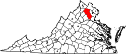 | |
| CDPs | ||
| Unincorporated communities | ||
| Footnotes | ‡This populated place also has portions in an adjacent county or counties | |