Opal, Virginia
| Opal, Virginia | |
|---|---|
| Census-designated place | |
|
Opal, Virginia | |
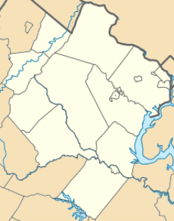 Opal  Opal  Opal Location within Fauquier county | |
| Coordinates: 38°37′15″N 77°48′00″W / 38.62083°N 77.80000°WCoordinates: 38°37′15″N 77°48′00″W / 38.62083°N 77.80000°W | |
| Country | United States |
| State | Virginia |
| County | Fauquier |
| Area | |
| • Total | 3.16 sq mi (8.19 km2) |
| • Land | 3.14 sq mi (8.12 km2) |
| • Water | 0.03 sq mi (0.07 km2) |
| Elevation | 449 ft (137 m) |
| Population (2010) | |
| • Total | 691 |
| • Density | 220/sq mi (85.1/km2) |
| Time zone | Eastern (EST) (UTC-5) |
| • Summer (DST) | EDT (UTC-4) |
| ZIP code | 20186 |
| FIPS code | 51-59416 |
| GNIS feature ID | 1499824 |
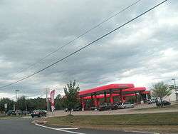
Opal (formerly Fayettesville) is an unincorporated community and census-designated place (CDP) in Fauquier County, Virginia, United States. It is on U.S. Highway 15/U.S. Route 17 and U.S. Route 29, at an elevation of 449 feet (137 m).[1] The population as of the 2010 census was 691.[2]
Geography
Opal is in western Fauquier County, 7 miles (11 km) south of Warrenton, the county seat, and 18 miles (29 km) northeast of Culpeper. US Route 17 diverges from Route 15 and 29 at Opal, leading southeast 31 miles (50 km) to Fredericksburg. Bealeton is directly south of Opal.
According to the U.S. Census Bureau, the Opal CDP has a total area of 3.2 square miles (8.2 km2), of which 0.03 square miles (0.07 km2), or 0.81%, is water.[2] The north and east sides of the community are part of the Potomac River watershed via Licking Run, Cedar Run, and the Occoquan River, while the west and south sides are part of the Rappahannock River watershed, via Tinpot Run and Bowens Run.
References
- ↑ U.S. Geological Survey Geographic Names Information System: Opal, Virginia
- 1 2 "Geographic Identifiers: 2010 Demographic Profile Data (G001): Opal CDP, Virginia". U.S. Census Bureau, American Factfinder. Retrieved October 19, 2016.
Municipalities and communities of Fauquier County, Virginia, United States | ||
|---|---|---|
| Towns | 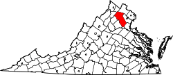 | |
| CDPs | ||
| Unincorporated communities | ||
| Footnotes | ‡This populated place also has portions in an adjacent county or counties | |