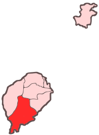
Caué District
| Caué | |
|---|---|
| District | |
 Location within São Tomé and Príncipe | |
| Coordinates: 0°5′N 6°35′E / 0.083°N 6.583°ECoordinates: 0°5′N 6°35′E / 0.083°N 6.583°E | |
| Country | São Tomé and Príncipe |
| Province/Island | São Tomé |
| Seat | São João dos Angolares |
| Area | |
| • Total | 267 km2 (103 sq mi) |
| Population (2008) | |
| • Total | 6,270 |
| • Density | 23/km2 (61/sq mi) |
| Time zone | UTC (UTC+0) |
Caué is a district of São Tomé Province. Out of the seven districts that make up the equatorial Atlantic islands of São Tomé and Príncipe, it is one of the smallest in terms of population, but is the largest in area covering approximately 267 square kilometers. Its population is 6,270 (2008 est.).[1] The district capital is São João dos Angolares. The equator lies in the southernmost part of the island. The municipality includes the small islet of Rólas which is south of the equator and being in the Southern Hemisphere.
Population
- 1940 6,675 (11.0% of the national population)
- 1950 6,942 (11.6% of the national population)
- 1960 5,874 (9.1% of the national population)
- 1970 3,757 (5.1% of the national population)
- 1981 4,607 (4.8% of the national population)
- 1991 5,322 (4.5% of the national population)
- 2001 5,501 (4.0% of the national population)
- 2008 6,270
Settlements
The main settlement is the town São João dos Angolares. Other settlements are:
- Dona Augusta
- Porto Alegre
- Ribeira Peixe
- Santa Josefina
- Vila Clotilde
Economy
50% of the district lied below the poverty line.
Its main industry is agriculture in the district and features several agricultural companies.[2]
References
 |
Lembá District | Mé-Zóchi District | Cantagalo District |  |
| |
||||
| ||||
| | ||||
| Atlantic Ocean | |
Atlantic Ocean |