Central Delhi
| Central Delhi | |
|---|---|
| District | |
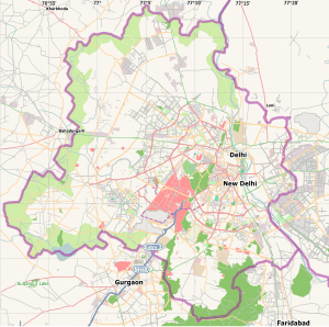 Central Delhi Location in Delhi, India | |
| Coordinates: 28°38′42″N 77°14′42″E / 28.64500°N 77.24500°ECoordinates: 28°38′42″N 77°14′42″E / 28.64500°N 77.24500°E | |
| Country |
|
| State | Delhi |
| Headquarters | Daryaganj |
| Government | |
| • Body | Municipal Corporation Of Delhi |
| Languages | |
| • Official | Hindi, English |
| Time zone | IST (UTC+5:30) |
| Lok Sabha constituency | Chandni Chowk |
| Civic agency | Municipal Corporation Of Delhi |
Central Delhi is an administrative district of the National Capital Territory of Delhi in India.
It is bounded by the Yamuna River on the east, and by the districts of North Delhi to the north, West Delhi and South West Delhi to the west, New Delhi to the south, and East Delhi to the east across the Yamuna..
Central Delhi has a population of 644,005 (2001 census), and an area of 25 square kilometres (9.7 sq mi), with a population density of 25,759 persons per km².
Central Delhi houses the central business district and highrises. It includes Shahjahanabad (Old Delhi) which served as capital of the Mughal Empire, and is home to the monuments like the Delhi Fort and the Jama Masjid, Delhi's principal mosque.
Administratively, the district is divided into two subdivisions, Darya Ganj, & Pahar Ganj.
Demographics
According to the 2011 census Central Delhi has a population of 578,671,[1] roughly equal to the nation of Solomon Islands[2] or the US state of Wyoming.[3] This gives it a ranking of 531st in India (out of a total of 640).[1] The district has a population density of 23,149 inhabitants per square kilometre (59,960/sq mi) .[1] Its population growth rate over the decade 2001-2011 was -10.48%.[1] Central Delhi has a sex ratio of 892 females for every 1000 males,[1] and a literacy rate of 85.25%.[1]
See also
References
- 1 2 3 4 5 6 "District Census 2011". Census2011.co.in. 2011. Retrieved 30 September 2011.
- ↑ US Directorate of Intelligence. "Country Comparison:Population". Retrieved 1 October 2011.
Solomon Islands 571,890 July 2011 est.
- ↑ "2010 Resident Population Data". U. S. Census Bureau. Archived from the original on 19 October 2013. Retrieved 30 September 2011.
Wyoming 563,626
External links
- Central Delhi District official website
- Central Delhi District Census 2011 Data
- List of places in Delhi
 |
West Delhi district | North Delhi district | | |
| |
East Delhi district | |||
| ||||
| | ||||
| South West Delhi district | New Delhi district |