Central Northeast
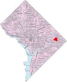
Map of Washington, D.C., with Central Northeast/Mahaning Heights highlighted in red
Central Northeast, also sometimes called Mahaning Heights, is a small neighborhood located in Northeast Washington, D.C with Fort Mahan Park at its center. It is bounded by Nannie Helen Burroughs Avenue to the north, Benning Road to the south, the tracks of the Washington Metro and Minnesota Ave station to the west, and 44th Street NE to the east.
It is home to the Friendship Collegiate Academy, a public charter high school.
This neighborhood is part of Ward 7.
External links
- National Park Service: Civil War History of Fort Mahan
- Friendship Schools: Friendship Collegiate Academy
 |
Mayfair | Eastland Gardens | Deanwood | |
| River Terrace | |
Lincoln Heights | ||
| ||||
| | ||||
| Benning | Benning Heights |
Coordinates: 38°53′44″N 76°56′29″W / 38.8955°N 76.9414°W
This article is issued from Wikipedia - version of the 11/18/2016. The text is available under the Creative Commons Attribution/Share Alike but additional terms may apply for the media files.