Woodland Normanstone
| Woodland-Normanstone | |
|---|---|
| Neighborhood of Washington, D.C. | |
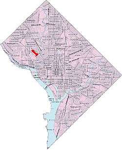 Map of Washington, D.C., with Woodland-Normanstone highlighted in red | |
| Coordinates: 38°55′15″N 77°03′39″W / 38.9207°N 77.0608°WCoordinates: 38°55′15″N 77°03′39″W / 38.9207°N 77.0608°W | |
| Country | United States |
| District | Washington, D.C. |
| Ward | Ward 3 |
| Government | |
| • Councilmember | Mary Cheh |
| Area | |
| • Land | 0.331 sq mi (0.86 km2) |
Woodland Normanstone is a small residential neighborhood in Northwest Washington, D.C., adjoining the larger neighborhoods of Woodley Park, Massachusetts Avenue Heights, and Observatory Circle.
The Woodland Normanstone neighborhood is bounded on by Garfield Street to the north, Cleveland Avenue and Calvert Street to the northeast, 28th Street to the east, Rock Creek Park to the southeast, Massachusetts Avenue to the southwest, and 34th Street to the west.[1] It is served by the Woodley Park Metro station on the Washington Metro Red Line.
Woodland Normanstone Neighborhood Association, established in 1989, represents the neighborhood.[2] There are no commercial businesses. It is a neighborhood of detached single-family homes.
Of the 160 houses in the neighborhood, 24 are residences for embassies.[1]
History
In the late 19th century, the land was the home of two farms and some woods and trees.[1]
Following approval by the District Commissioners,[3] Massachusetts Avenue was extended by way of a bridge over Rock Creek in 1904.[4]
In 1910, the 61st Congress gave an exception to the DC Grid rule, to a little bit of wilderness right in the middle of Washington. By curving around the hills, and by preserving the trees rather than cutting them, the developers created a neighborhood unlike most others in DC.
A group of real estate investors, called the Massachusetts Heights Company, purchased the 212-acre (0.86 km2) area for over $2,000,000 in 1911.[5] At the time of the sale, the new owners said they wanted to convert the wooded area into a "magical city".[5] The land was developed by Amos H. Plumb and American Security and Trust Company.[6] The developers built wide streets that conformed to the natural hilly topography.[6]
In 1917, the land was sold for several million dollars, which was the largest individual sale of real estate in the District of Columbia at the time.[6]
References
- 1 2 3 MacGraw, Eliza (June 28, 2013). "Where We Live: Woodland Normanstone in Northwest Washington". The Washington Post.
- ↑ Twomey, Steve (September 30, 1989). "Massachusetts Ave. Heights: Paradise Found". The Washington Post. p. F13.
- ↑ "Real Estate Market: Importance of the Extension of Massachusetts Avenue". The Washington Post. October 25, 1903. p. D3.
- ↑ "Real Estate Market: Important Developments Planned for Rock Creek". The Washington Post. January 10, 1904. p. A3.
- 1 2 "Millions in Realty: Involved in Deal Made Yesterday by Syndicate.". The Washington Post. February 4, 1911. p. 1.
- 1 2 3 "Record Property Sale: Massachusetts Avenue Heights Bring Millions of Dollars". The Washington Post. April 29, 1917. p. 12.