Chanpatia
| Chanpatia चनपटिया | |
|---|---|
| Town | |
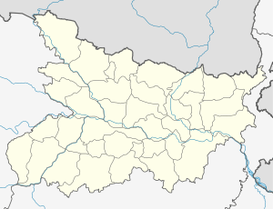 Chanpatia  Chanpatia Location in Bihar, India | |
| Coordinates: 26°56′44″N 84°33′09″E / 26.94543°N 84.55238°ECoordinates: 26°56′44″N 84°33′09″E / 26.94543°N 84.55238°E | |
| Country |
|
| State | Bihar |
| District | Pashchim Champaran |
| Population (2001) | |
| • Total | 22,029 |
| Languages | |
| • Official | Bhojpuri, Maithili, Hindi |
| Time zone | IST (UTC+5:30) |
| Lok Sabha constituency | Paschim Champaran |
| Vidhan Sabha constituency | Chanpatia |
| Website |
westchamparan |
Chanpatia is a city and a notified area in Paschim Champaran district in the state of Bihar, India.
Demographics
As of 2001 India census,[1] Chanpatia had a population of 22,029. Males constitute 52% of the population and females 48%. Chanpatia has an average literacy rate of 49%, lower than the national average of 59.5%; with male literacy of 58% and female literacy of 39%. 19% of the population is under 6 years of age.Major crop grown in this area are sugarcane, wheat and rice.Litchi is the famous fruit of chanpatia.
References
- ↑ "Census of India 2001: Data from the 2001 Census, including cities, villages and towns (Provisional)". Census Commission of India. Archived from the original on 2004-06-16. Retrieved 2008-11-01.
26°56′44″N 84°33′09″E / 26.94543°N 84.55238°E
This article is issued from Wikipedia - version of the 9/20/2016. The text is available under the Creative Commons Attribution/Share Alike but additional terms may apply for the media files.