Lalganj, Bihar
| Lalganj Vaishali | |
|---|---|
| Town | |
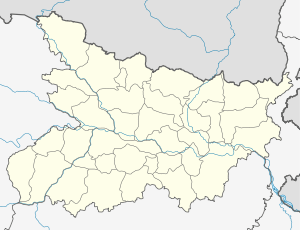 Lalganj Location in Bihar, India | |
| Coordinates: 25°52′N 85°11′E / 25.87°N 85.18°ECoordinates: 25°52′N 85°11′E / 25.87°N 85.18°E | |
| Country |
|
| State | Bihar |
| District | Vaishali |
| Elevation | 42 m (138 ft) |
| Population (2001) | |
| • Total | 29,847 |
| Languages | |
| • Official | Vajjika, Hindi |
| Time zone | IST (UTC+5:30) |
| PIN | 844121 |
| Lok Sabha constituency | Hajipur |
| Vidhan Sabha constituency | Lalganj |
| Website |
vaishali |
Lalganj is a municipality in Vaishali district in the Indian state of Bihar.
Geography
Lalganj is located at 25°52′N 85°11′E / 25.87°N 85.18°E.[1] It has an average elevation of 42 metres (137 feet). One of the famous temples in the city is 'Suryana Mandir' which is located in the middle of the city. Lalganj is a farser growing town of the vaishali district of Indian state of Bihar. It is 20 km far from Hajipur in north direction. This town is located on the bank of Narayani river.(Gandak River). Lalganj is 40 km far from the capital of bihar. The state highway 74 is going through Lalganj.
Demographics
As of 2001 India census,[2] Lalganj (Hindi: लाल गंज, Urdu: لال گنج) is a town and a nagar panchayat with 61 village panchayats in the Vaishali district of the Indian state of Bihar. It is Located on The bank of Narayani River(Gandak River).
Direction Board
 |
Siwan | Vaishali | Daltanganj | |
| Chhapra | |
Muzaffarpur | ||
| ||||
| | ||||
| Hajipur | Mahua | Kumar Bajitpur |
References
- ↑ Falling Rain Genomics, Inc - Lalganj
- ↑ "Census of India 2001: Data from the 2001 Census, including cities, villages and towns (Provisional)". Census Commission of India. Archived from the original on 2004-06-16. Retrieved 2008-11-01.
- ↑ "Lalganj Vaishali Pin code". citypincode.in. Retrieved 2014-05-19.