Cheorwon County
| Cheorwon 철원군 | ||
|---|---|---|
| County | ||
| Korean transcription(s) | ||
| • Hangul | 철원군 | |
| • Hanja | 鐵原郡 | |
| • Revised Romanization | Cheorwon-gun | |
| • McCune-Reischauer | Ch'ŏrwŏn-gun | |
| ||
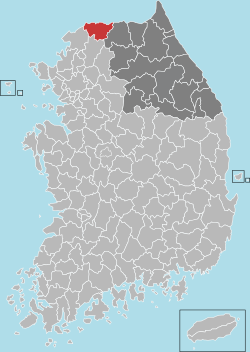 Location in South Korea | ||
| Country |
| |
| Region | Gwandong, Gyeonggi (before 1434) | |
| Administrative divisions | 4 eup, 3 myeon | |
| Area | ||
| • Total | 899.82 km2 (347.42 sq mi) | |
| Population (2001) | ||
| • Total | 54,040 | |
| • Density | 60.05/km2 (155.5/sq mi) | |
| • Dialect | Gangwon | |

Cheorwon County (Cheorwon-gun [tɕʰʌlwʌn ɡun]), also spelt Chorwon, is a county in Gangwon Province, South Korea. It is located right next to the border with North Korea.
History
- Goguryeo - First named Moeuldongbi.
- Silla Dynasty - name changed to Cheolseong.
- During the Later Three Kingdoms Period of Korea, Gung Ye determined it capital of Taebong.
- Goryeo Dynasty
- In 918, during the rule of King Taejo of Goryeo, its name was changed to Cheorwon and then renamed as Dongju.
- Joseon Dynasty
- King Taejong changed its name into 'Dohobu'.
- In 26th year of King Sejong's reign (1434), it was transferred from Gyeonggi-do to Gangwon.
- On May 26 of the King Gojong, altered to Chuncheon-bu.[1]
Korean War
Following the Division of Korea in 1945, all of Cheorwon County was part of North Korea.
During the Korean War the region changed hands several times during the UN invasion of North Korea and the Chinese invasion of South Korea, by 1951 the frontlines had stabilized, cutting across Cheorwon County and the area became part of the Iron Triangle battlefield. The Battle of White Horse took place north of Cheorwon town from 6–15 October 1952 and the Battle of Triangle Hill took place north of Gimhwa-eup from 14 October - 25 November 1952.
Following the signing of the Korean Armistice Agreement, the Korean Demilitarized Zone cut Cheorwon County in two, creating Cheorwon County in South Korea and Chorwon County in North Korea.
A number of Korean War sites in Cheorwon County are now tourist destinations including the former Woljeong-ri Station, the former Korean Workers’ Party Office, the Iron Triangle Tourist Office, the Second Incursion Tunnel and the Cheorwon Peace Observatory[2]
Symbol
- County Tree : Korean Nut Pine
- County Flower : Royal Azalea
- County Bird : Crane
Location
Cheorwon plays an important role in providing passage from Seoul to Wonsan and Kumgangsan
Since the expansion of the 43 National Road which connects Cheorwon and Seoul, the ease of transportation has been improved greatly.[3]
Climate
| Cheorwon, South Korea | ||||||||||||||||||||||||||||||||||||||||||||||||||||||||||||
|---|---|---|---|---|---|---|---|---|---|---|---|---|---|---|---|---|---|---|---|---|---|---|---|---|---|---|---|---|---|---|---|---|---|---|---|---|---|---|---|---|---|---|---|---|---|---|---|---|---|---|---|---|---|---|---|---|---|---|---|---|
| Climate chart (explanation) | ||||||||||||||||||||||||||||||||||||||||||||||||||||||||||||
| ||||||||||||||||||||||||||||||||||||||||||||||||||||||||||||
| ||||||||||||||||||||||||||||||||||||||||||||||||||||||||||||
| Climate data for Cheorwon (1981–2010) | |||||||||||||
|---|---|---|---|---|---|---|---|---|---|---|---|---|---|
| Month | Jan | Feb | Mar | Apr | May | Jun | Jul | Aug | Sep | Oct | Nov | Dec | Year |
| Average high °C (°F) | 0.7 (33.3) |
4.2 (39.6) |
9.8 (49.6) |
17.5 (63.5) |
22.5 (72.5) |
26.2 (79.2) |
27.7 (81.9) |
28.7 (83.7) |
24.8 (76.6) |
18.9 (66) |
10.4 (50.7) |
3.1 (37.6) |
16.2 (61.2) |
| Daily mean °C (°F) | −5.5 (22.1) |
−2.3 (27.9) |
3.5 (38.3) |
10.4 (50.7) |
16.3 (61.3) |
20.8 (69.4) |
23.5 (74.3) |
23.8 (74.8) |
18.7 (65.7) |
11.5 (52.7) |
4.1 (39.4) |
−2.8 (27) |
10.2 (50.4) |
| Average low °C (°F) | −11.4 (11.5) |
−8.3 (17.1) |
−2.5 (27.5) |
3.3 (37.9) |
10.3 (50.5) |
15.9 (60.6) |
20.0 (68) |
19.9 (67.8) |
13.5 (56.3) |
5.3 (41.5) |
−1.3 (29.7) |
−8.1 (17.4) |
4.7 (40.5) |
| Average precipitation mm (inches) | 20.6 (0.811) |
26.4 (1.039) |
40.2 (1.583) |
64.0 (2.52) |
102.0 (4.016) |
138.0 (5.433) |
400.9 (15.783) |
338.2 (13.315) |
148.5 (5.846) |
44.7 (1.76) |
46.4 (1.827) |
21.2 (0.835) |
1,391.2 (54.772) |
| Average precipitation days (≥ 0.1 mm) | 7.3 | 6.3 | 7.9 | 8.0 | 9.7 | 11.3 | 17.0 | 14.1 | 8.7 | 6.8 | 7.7 | 7.9 | 112.7 |
| Average relative humidity (%) | 68.9 | 64.9 | 62.6 | 58.9 | 65.5 | 72.1 | 80.7 | 79.9 | 76.8 | 72.9 | 71.1 | 70.6 | 70.4 |
| Mean monthly sunshine hours | 161.4 | 166.3 | 178.7 | 195.8 | 207.8 | 178.4 | 128.4 | 165.0 | 178.6 | 192.5 | 147.7 | 149.4 | 2,050.1 |
| Source: Korea Meteorological Administration[4] | |||||||||||||
Sister cities
See also
References
- ↑ :: Welcome to Cheorwon county! ::
- ↑ "PLZ (Peace & Life Zone) Section 4 Cherwon". Korea Tourism Organisation. Retrieved 4 June 2013.
- ↑ Welcome to Cheorwon county! ::
- ↑ "평년값자료(1981–2010) 철원(95)". Korea Meteorological Administration. Retrieved 2011-05-02.
- ↑ 제주특별자치도 서귀포시 방문을 환영합니다
External links

Coordinates: 38°12′33″N 127°13′03″E / 38.20917°N 127.21750°E