Cherokee Township, Cherokee County, Iowa
| Cherokee Township | |
|---|---|
| Township | |
 | |
| Coordinates: 42°46′46″N 095°33′46″W / 42.77944°N 95.56278°WCoordinates: 42°46′46″N 095°33′46″W / 42.77944°N 95.56278°W | |
| Country |
|
| State |
|
| County | Cherokee |
| Area | |
| • Total | 35.98 sq mi (93.19 km2) |
| • Land | 35.95 sq mi (93.1 km2) |
| • Water | 0.03 sq mi (0.09 km2) |
| Elevation[1] | 1,368 ft (417 m) |
| Population (2000) | |
| • Total | 6,073 |
| • Density | 168.9/sq mi (65.2/km2) |
| FIPS code | 19-90654[2] |
| GNIS feature ID | 0467596 |
Cherokee Township is one of sixteen townships in Cherokee County, Iowa, USA. As of the 2000 census, its population was 6,073.
Geography
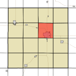
Cherokee Township covers an area of 35.98 square miles (93.2 km2) and contains one incorporated settlement, Cherokee (the county seat). According to the USGS, it contains four cemeteries: Memory Gardens, Mental Health Institute, Mount Calvary and Oak Hill.
References
- ↑ "US Board on Geographic Names". United States Geological Survey. 2007-10-25. Retrieved 2008-01-31.
- ↑ "American FactFinder". United States Census Bureau. Archived from the original on 2013-09-11. Retrieved 2008-01-31.
External links
Municipalities and communities of Cherokee County, Iowa, United States | ||
|---|---|---|
| Cities | ||
| Townships | ||
This article is issued from Wikipedia - version of the 11/21/2016. The text is available under the Creative Commons Attribution/Share Alike but additional terms may apply for the media files.