Chharchung
| Chharchung छर्चुङ | |
|---|---|
| Village | |
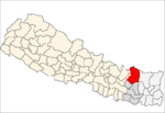
 Chharchung Location in Nepal | |
| Coordinates: 27°55′26″N 86°43′24″E / 27.92389°N 86.72333°ECoordinates: 27°55′26″N 86°43′24″E / 27.92389°N 86.72333°E | |
| Country | Nepal |
| Zone | Sagarmatha Zone |
| District | Solukhumbu District |
| VDC | Khumjung |
| Time zone | Nepal Time (UTC+5:45) |
Chharchung is a small village in Solukhumbu District in the Himalayas of Nepal. It lies to the southeast of the Gokyo Lakes and Gokyo village and north of Khumjung.[1] The village is located at an altitude of 4,502 metres (14,770 ft), making it one of the highest settlements in Nepal and in the world. The village is best viewed on Google Earth at 27°55′26″N 86°43′24″E / 27.92389°N 86.72333°E which reveals areas under cultivation,[2] suggesting a permanent settlement; it's not a known village along the hiking route to Gokyo. lying across the valley.
References
- ↑ "Chharchung". GeoNames. Retrieved 13 May 2012.
- ↑ Maps (Map). Google Earth.
Headquarter: Salleri | ||
|  | |
This article is issued from Wikipedia - version of the 3/18/2015. The text is available under the Creative Commons Attribution/Share Alike but additional terms may apply for the media files.