Chippendale, New South Wales
| Chippendale Sydney, New South Wales | |||||||||||||
|---|---|---|---|---|---|---|---|---|---|---|---|---|---|
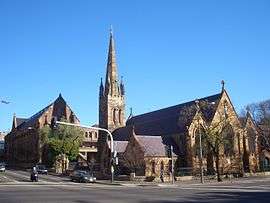 St Benedicts Church and University of Notre Dame | |||||||||||||
| Population | 4,057 (2011 census)[1] | ||||||||||||
| • Density | 5,808.6/km2 (15,044/sq mi) | ||||||||||||
| Postcode(s) | 2008 | ||||||||||||
| Area | 0.7 km2 (0.3 sq mi) | ||||||||||||
| Location | 2 km (1 mi) south of CBD | ||||||||||||
| LGA(s) | City of Sydney | ||||||||||||
| State electorate(s) | Newtown | ||||||||||||
| Federal Division(s) | Sydney | ||||||||||||
| |||||||||||||
_John_Storey_Memorial_Dispensary_1.JPG)
Chippendale is a small inner-city suburb of Sydney, New South Wales, Australia on the southern edge of the Sydney central business district, in the local government area of the City of Sydney. Chippendale is located between Broadway to the north and Cleveland Street to the south, Sydney Central railway station to the east and the University of Sydney to the west.
History
The area was first occupied by the Gadigal people of the Dharug Nation. William Chippendale was granted a 95-acre (38 ha) estate in 1819. It stretched to the present day site of Redfern railway station. Chippendale sold the estate to Solomon Levey, emancipist and merchant, in 1821, for 380 pounds. Solomon Levey died while in London, in 1833. Levey's heirs sold over 62 acres (25 ha) to William Hutchinson.[2][3]
Commercial area
The eastern side of Chippendale, being adjacent to the CBD has a greater mix use than other parts of the suburb. It includes smaller offices and warehouses as well as cafes and pubs.
Chippendale has also more recently become known as one of the key creative art districts of Sydney, with more than a dozen galleries in the small neighbourhood (including White Rabbit Gallery, MOP Projects, and Pine Street Creative Arts Centre). Various creative events in the suburb also take place each year such as the Beams Festival. Artist residencies were offered with the cooperation of Frasers during the construction of Central Park and Chippendale houses a lively creative community.
The historic Regent Street railway station or 'Mortuary Station' is located on the eastern side of the suburb.
The John Storey Memorial Dispensary was built in 1926 as a memorial to John Storey, a former Premier of New South Wales. It is located on Regent Street and still functions as a pathology and methadone clinic.
Central Park, Sydney

Chippendale is the location of the 168-year-old Carlton & United brewery which closed in December 2006. In 2007, Frasers Property Australia purchased the brewery site from the Foster’s Group and lodged a modified concept plan for the 5.8 Hectare site. Central Park, Sydney is the major renewal project in the area. The development proposal included approximately 255,000 m2 of commercial and residential space, retention of a number of heritage buildings and the development of a large new park for Chippendale, called Chippendale Green.[4] Balfour Street Park, at the corner of Balfour and O’Connor Streets, acts as a pedestrian gateway to Central Park. One Central Park is a large mixed-use residential building on the site.
Government and infrastructure
Transport New South Wales has its headquarters in Chippendale.[5]
Schools
The University of Notre Dame Australia sits along the northern border with campus buildings scatterd through the suburb. The University of Technology, Sydney and the University of Sydney have campuses nearby. The Sydney campus of Curtin University is located at the eastern edge of Chippendale on Regent Street. The Boston University Sydney Campus is located on Regent Street in Chippendale.
Population
Demographics
According to the 2011 census, there were 4,057 residents in Chippendale. 38.3% of people were born in Australia. The most common other countries of birth were China 10.6%, England 3.8%, New Zealand 3.3%, Indonesia 2.6% and India 2.5%. In Chippendale 50.1% of people only spoke English at home. Other languages spoken at home included Mandarin 10.5%, Cantonese 3.0%, Indonesian 2.2%, Thai 2.2% and Vietnamese 2.1%. The most common religious affiliation was "No Religion" 41%, followed by Catholic 14%, and Buddhism 8%.[1] Chippendale has a higher than average crime rate, compared with the rest of NSW.[6]
Notable residents
- William Chippendale, Sydney land owner and farmer whose surname the suburb's name is derived from
- David Malouf, writer[7]
- Michael Mobbs, author of Sustainable House[8]
Houses
The western side of Chippendale is mainly residential with businesses intercepted in some parts of the precinct. Notably, Chippendale has the lowest open space per person of any Sydney suburb (City of Sydney open space study, 2006). The addition of Chippendale Green has provided much needed green space, however given the corresponding population increase from the redevelopment of the former CUB site (now Central Park), Chippendale now has less than 1 square metre of green space per resident.
Urban heat island problem
Chippendale is currently a suburb under study, examining the problems of the urban heat island effect. The bitumen-surfaced roads surrounding infrastructures, are reportedly driving temperatures 6–8 °C (11–14 °F) higher than normal. The road network, which constitute over 23 percent of the suburb's land area, measured over 34 °C (93 °F) on average.[9]
Gallery
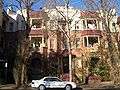 Chippen Street apartments
 Meagher Street flats and gallery
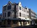 Former Shannon Hotel
 UTS Blackfriars Campus
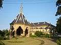 Mortuary Station
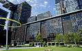 One Central Park
References
- 1 2 Australian Bureau of Statistics (31 October 2012). "Chippendale (State Suburb)". 2011 Census QuickStats. Retrieved 27 April 2014.
- ↑ The Book of Sydney Suburbs, Compiled by Frances Pollen, Angus & Robertson Publishers, 1996, Published in Australia ISBN 0-207-19007-0
- ↑ Libraries Australia. Part of Chippendale's grant. http://nla.gov.au/anbd.bib-an000040747752
- ↑ http://www.frasersbroadway.com.au/broadway/
- ↑ "Copyright and Disclaimer." Transport New South Wales. Retrieved 27 April 2014. "Transport NSW 18 Lee Street Chippendale NSW 2008"
- ↑ "Crime rates for Chippendale (2008) in NSW". Retrieved 26 August 2014.
- ↑ "Malouf, David 1934-". Retrieved 27 April 2014.
- ↑ "About Michael". Retrieved 27 April 2014.
- ↑ "The Urban Heat Island". Retrieved 26 August 2014.
Further reading
- Shirley Fitzgerald. CHIPPENDALE - Beneath The Factory Wall. Published by Halstead Press, Australia. 2008. (ISBN 9781920831486).
External links
- Shirley Fitzgerald (2008). "Chippendale". Dictionary of Sydney. Retrieved 26 September 2015. [CC-By-SA]
| Wikimedia Commons has media related to Chippendale, New South Wales. |
Coordinates: 33°53′11″S 151°12′00″E / 33.8863°S 151.1999°E