Chiquilistlán
| Chiquilistlán | |
|---|---|
| Municipality and town | |
 | |
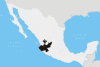
 Municipality location in Jalisco | |
|
Chiquilistlán Location in Mexico | |
| Coordinates: 19°58′N 103°42′W / 19.967°N 103.700°W | |
| Country |
|
| State | Jalisco |
| Area | |
| • Total | 432.31 km2 (166.92 sq mi) |
| Population (2005) | |
| • Total | 5,098 |
| Time zone | CST (UTC-6) |
| • Summer (DST) | CDT (UTC-5) |
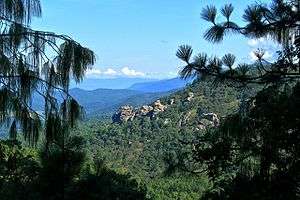
Chiquilistlán is a small town in the Mexican state of Jalisco. It is located in the Sierra Tapalpa mountains, at the foot of a hill called Chiquilichi, some 75 kilometres to the south-west of state capital Guadalajara.
Chiquilistlán is a municipal seat, serving as the administrative centre for the surrounding municipality (municipio) of the same name.
Coordinates: 19°58′01″N 103°43′01″W / 19.967°N 103.717°W
<img src="http://c2.ac-images.myspacecdn.com/images02/62/l_737c6eb7ec2d4287b7e5901d47748fc9.jpg" />
This article is issued from Wikipedia - version of the 2/19/2016. The text is available under the Creative Commons Attribution/Share Alike but additional terms may apply for the media files.