Chiseldon
| Chiseldon | |
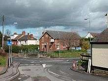
 Chiseldon Green |
|
 Chiseldon |
|
| Population | 2,667 (2011 Census)[1] |
|---|---|
| OS grid reference | SU188797 |
| Civil parish | Chiseldon |
| Unitary authority | Swindon |
| Ceremonial county | Wiltshire |
| Region | South West |
| Country | England |
| Sovereign state | United Kingdom |
| Post town | SWINDON |
| Postcode district | SN4 |
| Dialling code | 01793 |
| Police | Wiltshire |
| Fire | Dorset and Wiltshire |
| Ambulance | South Western |
| EU Parliament | South West England |
| UK Parliament | South Swindon |
| Website | Parish Council |
Coordinates: 51°30′58″N 1°43′52″W / 51.516°N 1.731°W
Chiseldon is a village and civil parish in the borough of Swindon, Wiltshire, England. It takes its name from the Old English cisel dene, or gravel valley, being noted in the Domesday Book as Chiseldene.[2]
The village lies on the edge of the Marlborough Downs, a mile south of junction 15 of the M4 motorway, on the A346 between Swindon and Marlborough. The large village of Wroughton is 2.5 miles (4 km) to the east. The parish includes the hamlets of Badbury. Badbury Wick, Draycot Foliat, Hodson, and Ridgeway View; in the north it includes the hamlet of Coate, on the edge of the southeast suburbs of Swindon. The ancient manor of Burderop is also within the parish.
The village houses a school, the Chiseldon Primary School, which currently has some 158 pupils enrolled, most of them from the village itself. The Holy Cross Church is also located in Chiseldon. The church was built in the thirteenth century along with other local churches in Ogbourne St. George and Ogbourne St. Andrew. The village has a surgery, as well as two hotels one of which is Chiseldon House Hotel, an attractive historic property. It also has an Esso petrol station, two shops (one housing a post office) and various other businesses. The engineering consultancy firm Halcrow Group Limited, soon to be CH2MHill, operates from Burderop Park, located in the parish.
There are two pubs in the village, The Patriots Arms and the Plough Inn. There is also the Social Club. The Elm Tree Pub has now closed down; this was originally a thatched beer house and was constructed in 1845 . The pub was named after the elm tree which was located on the village green until the 1970s.
Chiseldon telephone exchange serves 1048 residential and 39 non-residential properties.
History
Settlements in the area date back to prehistoric and Roman times, but Chiseldon itself was started by the Saxons. The village was included in the Domesday Book and was called Chiseldene at the time. At one point the nearby hamlet Draycot Foliat was larger than Chiseldon. Chiseldon lies on one of the country's oldest highways, the Icknield Way, although this section of the road is more commonly known as The Ridgeway.
The Midland and South Western Junction Railway line was constructed in 1881 and ran through the centre of the village until 1961, with a station that linked the village directly to Swindon Town station to the north and Marlborough to the south.
Chiseldon Army Camp was opened in 1914 and closed in 1962. During both World Wars it was heavily used as a training base for troops and was in World War II a major base for US Army Troops. Remaining houses now known as Ridgeway View.
Religion
Most of the population are members of the Church of England but other denominations of Christianity are present. Holy Cross Church of England parish church has a dwindling regular attendance but many more attend on special occasions. There is a small congregation of Methodists in the village. The Methodists had a 19th-century church in the village, but sold it in 2006 due to low finances, low attendance, and regulations requiring the Methodist church to comply with the Disability Discrimination Act by building a ramp, which the church could not afford. Holy Cross parish now lets the Methodists use the church hall for services. The two groups co-operate on occasions, such as a joint service in 2007 to commemorate the abolition of slavery.
Some villagers adhere to other major religions, but they are limited to a few families. Holy Cross parish is in the Church of England Diocese of Salisbury, unlike the rest of the borough of Swindon, which is within the Diocese of Bristol, but like the rest of Wiltshire.
The Parish

The Parish of Chiseldon encompasses not only the village but also the neighbouring hamlets of Coate, Draycot Foliat and Hodson. Draycot Foliat had its own church and parish in the medieval period, but in 1571 the Bishop of Salisbury ordered the church in Draycot to be demolished, as neither parish could sustain their own rectors any longer. As Chiseldon was the larger, Draycot was incorporated into its parish, and the materials from the church in Draycot were used to repair the church in Chiseldon.
Local government
As well as having its own elected parish council, Chiseldon also falls within the area of the Borough of Swindon unitary authority, which is responsible for all significant local government functions.
Local businesses
Local shops declined in the 20th century, like in many other villages, due to more people shopping in larger towns (Swindon) rather than in the village. Current local shops include Chaplins (a small newsagency), a hairdresser and a small supermarket (that offers many commodities and is larger than Chaplins or any other store in Chiseldon). The store was an old army barracks later converted into a shop. Until recently it was a SPAR convenience store but is now part of the 'Premier' chain, named Meadow Stores. Previous local businesses included a chip shop, which was run by a coal miner, whose customers apparently used to find traces of coal in their chips. Many other non-shop businesses survive. There also used to be a small village post office which was renamed the 'Penny Black' in 2007. It closed and the post office services were then offered in Meadow Stores until they stopped in 2013. The post office is now part of the Spa store which is on the site of the old Chaplins shop.
References
- ↑ "Chiseldon - 2011 Census". Neighbourhood Statistics. Office for National Statistics. Retrieved 15 August 2015.
- ↑ http://www.domesdaybook.co.uk/wiltshire1.html
External links
- Church web site
- Chiseldon FC Online
- Chiseldon Village weather
- Chiseldon Bells
- Chiseldon Domesday Book Record
- Victoria County History, Wiltshire, Vol.9, 1970, Parishes: Chiseldon, pp.6-23
- Chiseldon Parish Council
- Station House Surgery
| Wikimedia Commons has media related to Chiseldon. |
| Unitary authorities | |
|---|---|
| Major settlements | |
| Rivers | |
| Topics | |