Chitose-karasuyama Station
Chitose-Karasuyama Station 千歳烏山駅 | |
|---|---|
 East entrance, April 2012 | |
| Location |
6-1-1 Minami-Karasuyama, Setagaya, Tokyo (東京都世田谷区南烏山6-1-1) Japan |
| Operated by | Keio Corporation |
| Line(s) | Keio Line |
| Connections |
|
| Other information | |
| Station code | KO12 |
| History | |
| Opened | 1913 |
| Previous names | Karasuyama (until 1929) |
| Traffic | |
| Passengers (FY2011) | 74,518 daily |
Chitose-Karasuyama Station (千歳烏山駅 Chitose-karasuyama-eki) is a railway station on the Keio Line in Setagaya, Tokyo, Japan, operated by the private railway operator Keio Corporation.[1] It is the westernmost station of the Keio Line in the 23 special wards of Tokyo. Trains cross the Setagaya-Chōfu border west of the station.
Station layout
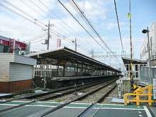
The station has two ground-level side platforms serving two tracks. Both platforms are connected by stairs to two small underground concourses beneath the tracks.
Platforms
| 1 | ■ Keio Line | for Chōfu, Hashimoto, Keiō-Hachiōji, and Takaosanguchi |
| 2 | ■ Keio Line | for Meidaimae, Sasazuka, Shinjuku, Toei Shinjuku Line |
Adjacent stations
| ← | Service | → | ||
|---|---|---|---|---|
| Keio Line | ||||
| Special Express: Does not stop at this station | ||||
| Meidaimae | Semi Special Express | Chōfu | ||
| Sakurajōsui | Express | Tsutsujigaoka | ||
| Sakurajōsui | Semi Express | Sengawa | ||
| Hachimanyama | Rapid | Sengawa | ||
| Roka-kōen | Local | Sengawa | ||
History
The station opened on April 15, 1913 as Karasuyama Station (烏山駅).[2] It was renamed Chitose-Karasuyama on 7 August 1929.[2]
Passenger statistics
In fiscal 2011, the station was used by an average of 74,518 passengers daily.[2]
Surrounding area
On both the north and south sides of the station lie large shopping districts. Just north of the station is the Karasuyama District Administration Office.
References
External links
| Wikimedia Commons has media related to Chitose-Karasuyama Station. |
- Keio station information (Japanese)
Coordinates: 35°40′04″N 139°36′02″E / 35.6679°N 139.6006°E