Chojna
| Chojna | ||
|---|---|---|
|
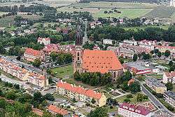
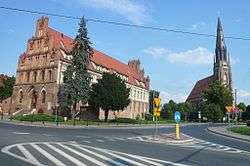
Panorama of the town | ||
| ||
 Chojna | ||
| Coordinates: 52°58′N 14°25′E / 52.967°N 14.417°E | ||
| Country |
| |
| Voivodeship | West Pomeranian | |
| County | Gryfino | |
| Gmina | Chojna | |
| Town rights | 1255 | |
| Government | ||
| • Mayor | Adam Fedorowicz | |
| Area | ||
| • Total | 12.12 km2 (4.68 sq mi) | |
| Population (2006) | ||
| • Total | 7,187 | |
| • Density | 590/km2 (1,500/sq mi) | |
| Time zone | CET (UTC+1) | |
| • Summer (DST) | CEST (UTC+2) | |
| Postal code | 74-500 | |
| Area code(s) | +48 91 | |
| Car plates | ZGR | |
| Website | http://www.chojna.pl | |

Chojna pronounced [ˈxɔi̯na] (German: Königsberg in der Neumark; Kashubian: Czińsbarg; Latin: Regiomontanus Neomarchicus "King's Mountain in (the) New March") is a small town in western Poland in the West Pomeranian Voivodeship. It lies approximately 60 kilometres (37 miles) south of Szczecin.
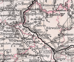
Chojna is located near two border crossings (Hohenwutzen and Schwedt) on the Oder River with Germany. It participates in the EU Douzelage town twinning initiative.[1]
History
High Middle Ages
From the 10th-12th centuries an early Pomeranian fortification, probably with a market, developed at the location of present-day Chojna. Because of its favorable location on trading routes leading to the principalities of Greater Poland and the duchies of Pomerania, the settlement developed quickly. Duke Boguslaw I of Pomerania was entombed in the settlement's church after his death in 1187. After 1200 the settlement received Magdeburg rights from Duke Barnim I the Good. It was referred to as "Konigesberge" for the first time in 1244 and passed to the Bishopric of Brandenburg after Bishop Otto of Brandenburg had acquired part of the New March in 1252. Populated with German knights and colonists, the town's name "Konigesberge" evolved into the German name "Königsberg" ("King's Mountain"), with the epithet in der Neumark (i.e. in the New March) added to distinguish it from namesakes in East Prussia and Bavaria. After in 1267 Bishop Henry I of Brandenburg had ceded the "terra Konigesberge" to the Ascanian Margraves of Brandenburg, the town was granted the right to hold a market as well as regional legal jurisdiction, causing it to become the main town of the New March at that time.
Late Middle Ages
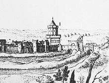
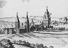
A parish church existed by 1282, while an Augustinian monastery was founded in 1290. From 1310 to 1329 the town experienced an economic boom linked to the grain trade, and received further market privileges. The town hall was built in 1320. Trade goods were shipped over the Oder and Röhricke rivers. During the 13th and 14th centuries a defensive wall was built around the town with numerous towers and three city gates (Schwedter Tor, Bernikower Tor, and Vierradener Tor — the latter demolished in the 19th century). From 1402 to 1454 the town was under the control of the Teutonic Knights after the March of Brandenburg had pawned all the New March to them. The Church of St. Mary and the new town hall (1410) built during this time were some of the most aesthetically pleasing Gothic buildings in the New March.
Renaissance
The strong town withstood an attack by the Hussites in 1433 during the Hussite Wars. The town flourished economically during the German Renaissance beginning in the 15th century, but the majority of its population died from three plagues during the 16th and 17th centuries. It had several churches: the Augustinian monastery church, the Augustinian hospital church of the Holy Spirit, and the Churches of Saints Mary, Nicholas, George, and Gertrude. The town gradually converted to Lutheranism from 1539-1553 during the Protestant Reformation, resulting in the dissolution of the monastery in 1536. Its buildings were instead used as a hospital and school, while its church was used as a storehouse, before in 1690 it was reopened as a Protestant church. During the Thirty Years' War, the town was occupied at different times by the Imperial troops of Albrecht von Wallenstein and the Swedish troops of King Gustavus Adolphus, in the course of which the town was destroyed by 52%. After the destruction of the Church of St. Mary's tower by a lightning bolt in 1682, reconstruction commenced until 1692.
Early modern age
In the church, a new Baroque pulpit was built in 1714, as well as an organ built by Joachim Wagner in 1734. The town began to revive economically after the foundation of the Kingdom of Prussia, becoming the seat of the government (Kriegs- und Domainenkammer) of the New March in 1759 during the Seven Years' War. In 1767 the city gates towards Schwedt and Bernikow were partially dismantled to provide stone for the construction of a military barracks at the former monastery. The town's inhabitants initially specialised in agriculture and forestry and later in weaving of fine textiles. That industry declined, however with the onset of industrialisation, around 1840. The place became the county seat of the Königsberg district in 1809 and part of the Frankfurt Region in the Prussian Province of Brandenburg in 1816. With Prussia the town became part of the German Empire in 1871 and flourished after being connected to the railway network in 1877. It also served as an educational and administrative centre for the surrounding region.
World War II
In 1939 the Luftwaffe constructed an airfield near Königsberg, used on by the Soviet Air Forces between 1945 and 1992. A concentration camp was set up for the Polish slave labour.[2] In January 1945 battles of the Vistula–Oder Offensive occurred in and around the town. The German population fled in haste warned about the mass rapes. On 4 February 1945 Kurt Flöter, Königsberg's then mayor, was condemned to death by hanging by an SS court martial chaired by Otto Skorzeny, because he had fled before issuing a general evacuation order by the military. On the same day the Soviet Red Army occupied the town. The entire city centre with the Church of St. Mary and the town hall was burned to the ground by the Soviets on 16 February 1945. The town was destroyed by 80 percent. After the German capitulation, under border changes promulgated at the Potsdam Conference, the town became part of Poland.
Poland
The town was first renamed as Władysławsko by June 1945. On 21 August 1945 the name was changed to Królewiec nad Odrą (i.e. literally King's town upon Oder). On 7 May 1946 the town was renamed again as Chojna nad Odrą. Chojna was gradually repopulated by the Poles.
Vestiges of the war are still visible in some of Chojna's buildings. The foundation wall of the destroyed town hall was rebuilt for use as a cultural centre, town library, and public house. The monastery was also reconstructed, while the marketplace was newly built. Reconstruction of the destroyed Marienkirche began in 1994 as a joint German-Polish cooperation. In 1997 the roof of the church's nave was covered, while the pyramidal tower roof of the tower was reconditioned in a 19th-century Neo-gothic style. Chojna's two main landmarks are thus the town hall and the Church of St. Mary, both historical buildings by the Gothic architect Hinrich Brunsberg.
Number of inhabitants by years
| Year | Number[3][4][5][6] |
|---|---|
| 1719 | 1,371 |
| 1750 | 2,210 |
| 1801 | 3,249 |
| 1850 | 5,292 |
| 1875 | 6,350 |
| 1880 | 6,568 |
| 1890 | 5,864 |
| 1933 | 6,276 |
| 1939 | 6,756 |
| 2006 | 7,187 |
| 2011 | 7,378 |
Sights
Chojna is on The European Route of Brick Gothic.
- Cathedral
- The Augustinian monastery and the remains of the city wall with the Schwedt and Bernikow Gates.
- The Giant Plane in the former Viereck'scher Garten.
Notable residents
- Carl Friedrich von Beyme (1765-1838), politician
- Wolf-Dieter Hütteroth (1930–2010), geographer, professor of the Frederick-Alexander University in Erlangen and Nuremberg
- Adalbert Kuhn (1812-1881), scientist
- Ernst Marow (b. 1934), painter and graphic artist
International relations
Twin towns - Sister cities
Chojna is a member of the Douzelage, a unique town twinning association of 24 towns across the European Union. This active town twinning began in 1991 and there are regular events, such as a produce market from each of the other countries and festivals.[1][7] Discussions regarding membership are also in hand with three further towns (Agros in Cyprus, Škofja Loka in Slovenia, and Tryavna in Bulgaria).
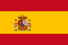 Altea, Spain - 1991
 Bad Kötzting, Germany - 1991
 Bellagio, Italy - 1991
 Bundoran, Ireland - 1991
 Granville, France - 1991
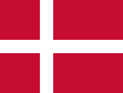 Holstebro, Denmark - 1991
.svg.png) Houffalize, Belgium - 1991
Houffalize, Belgium - 1991 Meerssen, the Netherlands - 1991
 Niederanven, Luxembourg - 1991
 Preveza, Greece - 1991
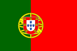 Sesimbra, Portugal - 1991
 Sherborne, United Kingdom - 1991
 Karkkila, Finland - 1997
 Oxelösund, Sweden - 1998
 Judenburg, Austria - 1999
 Chojna, Poland - 2004
 Kőszeg, Hungary - 2004
 Sigulda, Latvia - 2004
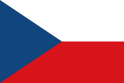 Sušice, Czech Republic - 2004
 Türi, Estonia - 2004
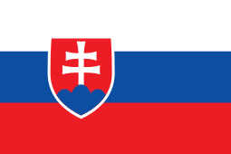 Zvolen, Slovakia - 2007
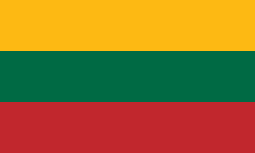 Prienai, Lithuania - 2008
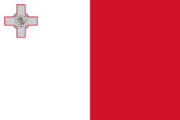 Marsaskala, Malta - 2009
 Siret, Romania - 2010
References
 This article incorporates text from a publication now in the public domain: Chisholm, Hugh, ed. (1911). "article name needed". Encyclopædia Britannica (11th ed.). Cambridge University Press.
- This article contains information translated from the German Wikipedia's Chojna article, accessed May 26, 2006.
Notes
- 1 2 "Douzelage.org: Member Towns". www.douzelage.org. Retrieved 2009-10-21.
- ↑ Ulrich Herbert; Karin Orth; Christoph Dieckmann (1998). Die nationalsozialistischen Konzentrationslager. Ravensbrück by Bernhard Strebel. Wallstein Verlag. pp. 233–234. ISBN 3892442894. Retrieved 25 February 2015.
- ↑ Michael Rademacher: Deutsche Verwaltungsgeschichte – Königsberg in der Neumark (2006) (in German).
- ↑ Berghaus (1856), p. 387 and p. 391.
- ↑ Friedrich Wilhelm August Bratring: Statistisch-topographische Beschreibung der gesammten Mark Brandenburg. Band 3: 'Die Neumark Brandenburg'. Berlin 1809, p. 98.
- ↑ Heinrich Berghaus: Landbuch der Mark Brandenburg und des Markgrafenthums Nieder-Lausitz in der Mitte des 19. Jahrhunderts. Band 3, 1. Ausgabe, Brandenburg 1856, p. 387 (in German).
- ↑ "Douzelage.org: Home". www.douzelage.org. Retrieved 2009-10-21.
External links
| Wikimedia Commons has media related to Chojna. |
- Municipal website (Polish)
- Reconstruction of the Church of St. Mary (German)
- Genealogical information about Königsberg in der Neumark (German)
- Jewish Community in Chojna on Virtual Shtetl
Coordinates: 52°58′N 14°25′E / 52.967°N 14.417°E
European Union: Members of the town twinning "Douzelage" | ||
|---|---|---|