Clarence Park, South Australia
| Clarence Park Adelaide, South Australia | |||||||||||||
|---|---|---|---|---|---|---|---|---|---|---|---|---|---|
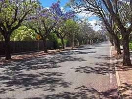 Churchill Avenue, looking south towards Cross Road | |||||||||||||
| Population | |||||||||||||
| Established | 1892[3] | ||||||||||||
| Postcode(s) | 5034 | ||||||||||||
| Location | 4 km (2 mi) from Adelaide | ||||||||||||
| LGA(s) | City of Unley | ||||||||||||
| State electorate(s) | Ashford | ||||||||||||
| Federal Division(s) | Adelaide | ||||||||||||
| |||||||||||||
Clarence Park (formerly Goodwood South)[3] is an inner southern suburb of Adelaide, South Australia in the City of Unley. Its borders are Mills Street (north), Goodwood Road (east), Cross Road (south) and the Seaford railway line (north-west).[4]
History
Goodwood Park Post Office opened on 27 December 1877, was renamed Goodwood South in 1884, Clarence Park in 1910 and was replaced by a new Cumberland Park office in 1993.[5]
Facilities
The Clarence Park Community Centre[6] is located just over the train line on East Avenue, in the suburb of Black Forest. The centre caters for many clubs, provides courses, and is adjacent to the Clarence Park Biodiversity Garden.[7] Clarence Park Community Kindergarten[8] is located on Parker Terrace in Clarence Park, offering kindergarten and playgroup to the local community.
References
- ↑ Australian Bureau of Statistics (31 October 2012). "Clarence Park (State Suburb)". 2011 Census QuickStats. Retrieved 23 June 2014.
- ↑ Australian Bureau of Statistics (25 October 2007). "Clarence Park (State Suburb)". 2006 Census QuickStats. Retrieved 26 May 2008.
- 1 2 "Manning Index of South Australian History".
- ↑ 2003 Adelaide Street Directory, 41st Edition. UBD (A Division of Universal Press Pty Ltd). 2003. ISBN 0-7319-1441-4.
- ↑ Premier Postal History. "Post Office List". Premier Postal Auctions. Retrieved 26 May 2011.
- ↑ Clarence Park Community Centre, City of Unley.
- ↑ Clarence Park Biodiversity Garden, City of Unley
- ↑
External links
Coordinates: 34°57′47″S 138°35′10″E / 34.963°S 138.586°E