Clear Creek (East)
| East Clear Creek | |
|---|---|
 | |
| Country | United States |
| Basin | |
| Main source | 6,800 ft (2,100 m) |
| River mouth | 5,300 ft (1,600 m) |

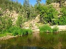
East Clear Creek at Forest Road 95
East Clear Creek is located in the Mogollon Rim area of the state of Arizona. The closest town Winslow is 45 miles away.
Location
- Mouth
- Confluence with Clear Creek, Coconino County, Arizona: 34°37′25″N 111°02′22″W / 34.62364°N 111.03958°W[1]
- Source
- Coconino County, Arizona: 34°27′55″N 111°20′27″W / 34.46531°N 111.34097°W[1]
Fish species
General information
- Fishable Miles: 34
External links
- Arizona Fishing Locations Map
- Where to Fish in Arizona Species Information
- Arizona Boating Locations Facilities Map
- Arizona Lake Levels
- Video of East Clear Creek
References
- 1 2 "East Clear Creek". Geographic Names Information System. United States Geological Survey. Retrieved 2014-02-05.
- Arizona Fishin' Holes, Phoenix, AZ: Arizona Game and Fish Department, 2007
|first1=missing|last1=in Authors list (help)
This article is issued from Wikipedia - version of the 11/26/2016. The text is available under the Creative Commons Attribution/Share Alike but additional terms may apply for the media files.