Col de Portel
| Col de Portel | |
|---|---|
 Location of Col de Portel | |
| Elevation | 1,432 m (4,698 ft) |
| Traversed by | D72 |
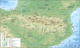
| Location | Ariège, France |
| Range | Pyrenees |
| Coordinates | 42°55′43″N 01°21′28″E / 42.92861°N 1.35778°ECoordinates: 42°55′43″N 01°21′28″E / 42.92861°N 1.35778°E |
Col de Portel (el. 1,432 m.) is a mountain pass in the French Pyrenees between Saint-Girons and Foix in the "massif de l'Arize".
Details of the climb
From Saint-Girons (west), the climb to the Col de Portel crosses the Col de la Crouzette (1,241 m). To the Col de la Crouzette the climb is 11.2 km long, at an average gradient of 6.5%, with a short section at 10.8%. From the Col de la Crouzette to the summit is a further 3.5 km, gaining an extra 191 m, with the steepest section (near the summit) at 8.0%.
Starting from la Mouline, (east) the climb to the Col de Portel crosses the Mur de Péguère (1,375 m). To the Mur de Péguère the climb is 18 km long; over this distance, the climb is 872 m (an average of 4.8%). From the Mur de Péguère to the summit is a further 3.5 km, gaining a further 57 m height.
Appearances in the Tour de France
The Col de Portel was crossed on stage 11 of the 2008 Tour de France.
| Year | Stage | Category | Start | Finish | Leader at the summit |
|---|---|---|---|---|---|
| 2008 | 11 | 1 | Lannemezan | Foix | Amaël Moinard |
See also
External links
- Profile of climb from la Mouline to Col de Péguère on climbbybike.com
- Profile of climb from Col de la Crouzette to Col de Péguère on climbbybike.com
- Le col de Portel dans le Tour de France (French)
- Photos of Col de Portel