Colorado State Highway 9
| ||||
|---|---|---|---|---|
|
Map of central Colorado with SH 9 highlighted in red | ||||
| Route information | ||||
| Maintained by CDOT | ||||
| Length: | 138.92 mi[1] (223.57 km) | |||
| Major junctions | ||||
| South end: |
| |||
| North end: |
| |||
| Location | ||||
| Counties: | Fremont, Park, Summit, Grand | |||
| Highway system | ||||
|
Colorado State Highways
| ||||


State Highway 9 (SH 9) in the U.S. state of Colorado is a 138-mile-long (222 km) state highway through central Colorado.
Route description
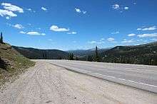
State Highway 9 starts at a junction with US 50 west of Cañon City. It heads northwest, following Currant Creek most of the way to Currant Creek Pass where it enters an open area known as South Park. The south fork of the South Platte is crossed as the highway enters Hartsel and a junction with US 24. SH 9 follows US 24 west for 0.5 mi (0.80 km), then splits off to head northwest again. Just south of Fairplay, it joins northbound US 285. At Fairplay SH 9 leaves US 285 to head northwest, following the middle fork of the South Platte most of the way to Hoosier Pass where it crosses the Continental Divide 11,532 ft (3,515 m) above sea level. Switchbacks drop the highway to the Blue River which it follows north through Breckenridge to Dillon Reservoir. The highway goes around the west side of the reservoir, through Frisco and joins I 70 as it heads northeast. At Silverthorne, SH 9 leaves I 70 to continue northwest alongside the Blue River. SH 9 crosses the Colorado River just before its termination at a junction with US 40 in Kremmling.[2]
Major intersections
| County | Location | mi | km | Destinations | Notes |
|---|---|---|---|---|---|
| Fremont | | 0.000 | 0.000 | Southern terminus | |
| Park | Hartsel | 46.980 | 75.607 | South end of US 24 overlap | |
| | 47.582 | 76.576 | North end of US 24 overlap | ||
| | 63.732 | 102.567 | South end of US 285 overlap | ||
| Fairplay | 64.673 | 104.081 | North end of US 285 overlap | ||
| Summit | Frisco | 96.998 | 156.103 | South end of I-70 overlap | |
| Silverthorne | 101.562 | 163.448 | North end of I-70 overlap | ||
| Grand | Kremmling | 138.920 | 223.570 | ||
| 1.000 mi = 1.609 km; 1.000 km = 0.621 mi | |||||
References
- ↑ "Segment list for SH 9". Retrieved 2007-05-12.
- ↑ Colorado Atlas & Gazetteer (3rd ed.). Yarmouth, Maine: DeLorme. 1997. pp. 27, 37, 38, 61. ISBN 0-89933-206-4.
External links
- Colorado Highways link to State Highway 9