Cookshire-Eaton, Quebec
| Cookshire-Eaton | |
|---|---|
| City | |
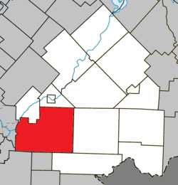 Location within Le Haut-Saint-François RCM. | |
 Cookshire-Eaton Location in southern Quebec. | |
| Coordinates: 45°25′N 71°38′W / 45.417°N 71.633°WCoordinates: 45°25′N 71°38′W / 45.417°N 71.633°W[1] | |
| Country |
|
| Province |
|
| Region | Estrie |
| RCM | Le Haut-Saint-François |
| Constituted | July 24, 2002 |
| Government[2] | |
| • Mayor | Noël Landry |
| • Federal riding | Compton—Stanstead |
| • Prov. riding | Mégantic |
| Area[2][3] | |
| • Total | 298.70 km2 (115.33 sq mi) |
| • Land | 295.95 km2 (114.27 sq mi) |
| Population (2011)[3] | |
| • Total | 5,171 |
| • Density | 17.5/km2 (45/sq mi) |
| • Pop 2006-2011 |
|
| Time zone | EST (UTC−5) |
| • Summer (DST) | EDT (UTC−4) |
| Postal code(s) | J0B 1M0 |
| Area code(s) | 819 |
| Highways |
|
| Website |
www |
Cookshire-Eaton is a city in the Estrie region of Quebec. It is the seat of Le Haut-Saint-François Regional County Municipality. Sherbrooke Airport is located there.
As part of the 2000–2006 municipal reorganization in Quebec, on July 24, 2002 the city of Cookshire, the municipality of Newport and the township of Eaton were merged to form Cookshire-Eaton;[4] prior to this, on April 25, 2001, the village of Sawyerville had merged with Eaton.[5] After a 2004 referendum, however, Newport de-merged and was reconstituted as an independent municipality as of January 1, 2006. Nevertheless, Newport and Cookshire-Eaton both remain part of the urban agglomeration of Cookshire-Eaton.
The community had a population of 5,171 in the Canada 2011 Census.
References
- ↑ Reference number 377747 of the Commission de toponymie du Québec (French)
- 1 2 Geographic code 41038 in the official Répertoire des municipalités (French)
- 1 2 "(Code 2441038) Census Profile". 2011 census. Statistics Canada. 2012.
- ↑ http://www.stat.gouv.qc.ca/publications/referenc/pdf/modjuillet02.pdf
- ↑ http://www.toponymie.gouv.qc.ca/ct/ToposWeb/fiche.aspx?no_seq=58724
 |
Ascot Corner | Westbury | | |
| Sherbrooke Waterville |
|
Newport | ||
| ||||
| | ||||
| Compton | Martinville | Saint-Isidore-de-Clifton |
| Cities & Towns | |
|---|---|
| Municipalities | |
| Townships | |
| |