Cooleemee, North Carolina
| Cooleemee, North Carolina | ||
|---|---|---|
| Town | ||
| ||
 Location of Cooleemee, North Carolina | ||
| Coordinates: 35°48′52″N 80°33′22″W / 35.81444°N 80.55611°WCoordinates: 35°48′52″N 80°33′22″W / 35.81444°N 80.55611°W | ||
| Country | United States | |
| State | North Carolina | |
| County | Davie | |
| Area | ||
| • Total | 0.8 sq mi (2.0 km2) | |
| • Land | 0.8 sq mi (2.0 km2) | |
| • Water | 0.0 sq mi (0.0 km2) | |
| Elevation | 738 ft (225 m) | |
| Population (2010) | ||
| • Total | 960 | |
| • Density | 1,166.6/sq mi (450.4/km2) | |
| Time zone | Eastern (EST) (UTC-5) | |
| • Summer (DST) | EDT (UTC-4) | |
| ZIP code | 27014 | |
| Area code(s) | 336 | |
| FIPS code | 37-14460[1] | |
| GNIS feature ID | 0983492[2] | |
| Website | Town of Cooleemee Official website | |

Cooleemee (/kuːləmi/ KOO-lə-mee)[3] is a town in Davie County, North Carolina, United States. The population was 960 at the 2010 census.
History
Cooleemee Mill Town Historic District and the Foard-Tatum House are listed on the National Register of Historic Places.[4][5]
Geography
Cooleemee is located at 35°48′52″N 80°33′22″W / 35.81444°N 80.55611°W (35.814509, -80.556180).[6]
According to the United States Census Bureau, the town has a total area of 0.8 square miles (2.1 km2), all of it land.
Demographics
| Historical population | |||
|---|---|---|---|
| Census | Pop. | %± | |
| 1990 | 971 | — | |
| 2000 | 905 | −6.8% | |
| 2010 | 960 | 6.1% | |
| Est. 2015 | 972 | [7] | 1.3% |
As of the census[1] of 2000, there were 905 people, 400 households, and 254 families residing in the town. The population density was 1,166.6 people per square mile (448.0/km²). There were 456 housing units at an average density of 587.8 per square mile (225.7/km²). The racial makeup of the town was 91.71% White, 5.41% African American, 0.33% Native American, 1.10% from other races, and 1.44% from two or more races. Hispanic or Latino of any race were 4.09% of the population.
There were 400 households out of which 25.5% had children under the age of 18 living with them, 49.3% were married couples living together, 8.5% had a female householder with no husband present, and 36.5% were non-families. 32.8% of all households were made up of individuals and 18.3% had someone living alone who was 65 years of age or older. The average household size was 2.26 and the average family size was 2.85.
In the town the population was spread out with 22.0% under the age of 18, 7.4% from 18 to 24, 26.7% from 25 to 44, 22.7% from 45 to 64, and 21.2% who were 65 years of age or older. The median age was 40 years. For every 100 females there were 103.8 males. For every 100 females age 18 and over, there were 97.2 males.
The median income for a household in the town was $29,833, and the median income for a family was $37,875. Males had a median income of $26,705 versus $20,813 for females. The per capita income for the town was $17,148. About 9.6% of families and 12.4% of the population were below the poverty line, including 18.6% of those under age 18 and 8.2% of those age 65 or over.
Notable people
- Jack Crouch, baseball player
- Buck Jordan, baseball player
See also
- Cooleemee, an homonymous estate
References
- 1 2 "American FactFinder". United States Census Bureau. Archived from the original on 2013-09-11. Retrieved 2008-01-31.
- ↑ "US Board on Geographic Names". United States Geological Survey. 2007-10-25. Retrieved 2008-01-31.
- ↑ Talk Like A Tarheel, from the North Carolina Collection's website at the University of North Carolina at Chapel Hill. Retrieved 2012-09-25.
- ↑ National Park Service (2010-07-09). "National Register Information System". National Register of Historic Places. National Park Service.
- ↑ "National Register of Historic Places Listings". Weekly List of Actions Taken on Properties: 9/22/14 through 9/26/14. National Park Service. 2014-10-03.
- ↑ "US Gazetteer files: 2010, 2000, and 1990". United States Census Bureau. 2011-02-12. Retrieved 2011-04-23.
- ↑ "Annual Estimates of the Resident Population for Incorporated Places: April 1, 2010 to July 1, 2015". Retrieved July 2, 2016.
- ↑ "Census of Population and Housing". Census.gov. Archived from the original on May 11, 2015. Retrieved June 4, 2015.
External links
Municipalities and communities of Davie County, North Carolina, United States | ||
|---|---|---|
| Towns | 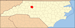 | |
| CDP | ||
| Unincorporated communities | ||