Cortlandt Street (BMT Broadway Line)
| Cortlandt Street | |||||||||
|---|---|---|---|---|---|---|---|---|---|
| New York City Subway rapid transit station | |||||||||
|
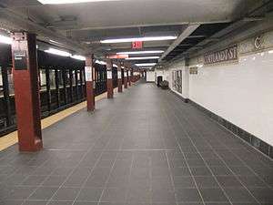
Uptown (northbound) platform | |||||||||
| Station statistics | |||||||||
| Address |
Cortlandt Street & Church Street New York, NY 10280 | ||||||||
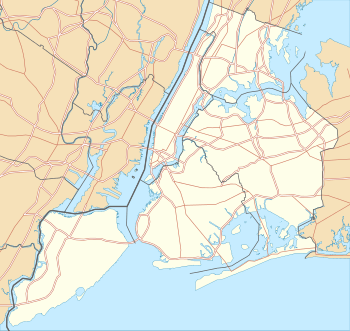
| Borough | Manhattan | ||||||||
| Locale | Financial District, World Trade Center | ||||||||
| Coordinates | 40°42′39″N 74°00′40″W / 40.710735°N 74.011245°WCoordinates: 40°42′39″N 74°00′40″W / 40.710735°N 74.011245°W | ||||||||
| Division | B (BMT) | ||||||||
| Line | BMT Broadway Line | ||||||||
| Services |
N R W | ||||||||
| Transit connections |
| ||||||||
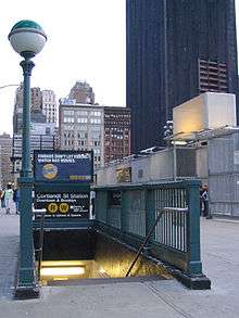
| Structure | Underground | ||||||||
| Platforms | 2 side platforms | ||||||||
| Tracks | 2 | ||||||||
| Other information | |||||||||
| Opened |
January 5, 1918[1] (original) September 15, 2002 (first reopening) | ||||||||
| Closed |
September 11, 2001 (first closing) August 20, 2005 (second closing) | ||||||||
| Rebuilt |
November 25, 2009 (northbound platform)[2] September 6, 2011 (southbound platform)[3][4] | ||||||||
| Accessible |
| ||||||||
| Wireless service |
| ||||||||
| Former/other names | Cortlandt Street–World Trade Center | ||||||||
| Traffic | |||||||||
| Passengers (2015) |
2,713,532[6] | ||||||||
| Rank | 185 out of 422 | ||||||||
| Station succession | |||||||||
| Next north |
City Hall: N | ||||||||
| Next south |
Rector Street: N | ||||||||
|
| |||||||||
| Next |
14th Street–Union Square: N | ||||||||
| Next |
Jay Street–MetroTech: N none: W | ||||||||
| |||||||||
| |||||||||


Cortlandt Street is a local station on the BMT Broadway Line of the New York City Subway, located under Church Street, between Fulton and Cortlandt Streets in Lower Manhattan. It is served by the R train at all times except late nights, when the N train takes over service. The W train also serves this station on weekdays.
Station layout
| G | Street Level | Exit/Entrance |
| B1 Platform level |
Side platform, doors will open on the right | |
| Northbound | ← ← | |
| Southbound | → → → | |
| Side platform, doors will open on the right | ||
| B2 | Crossunder, Exit/Entrance via Dey Street Passageway | |
This underground station, opened on January 5, 1918,[1] has two tracks and two side platforms. It is the closest station on the BMT Broadway Line to the World Trade Center and an exit at the north end once led to the original lower concourse. Both platforms are now connected to the World Trade Center Transportation Hub via an underpass and to the Fulton Center via the Dey Street Passageway.
Station work

Renovations
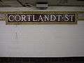
The station was overhauled in the late 1970s, with repairs made to the structural and cosmetic appearance. The original BMT wall tiles were covered over with the MTA's then-standard large rectangular wall tiles, with bolted-on signs replacing the "Cortlandt Street" mosaics in the wall. Lighting was converted from incandescent to fluorescent and staircases and platform edges were repaired. Much of the cosmetic change that came with this renovation was undone in a subsequent 1998–1999 renovation. In addition to "state-of-repair" work and upgrades for ADA accessibility, the station's original 1918 tilework was restored. Other improvements were made to the public address system, directional signage, and concrete trackbeds.
The Dey Street Passageway, outside of the fare control, connects the Fulton Street station complex to the Cortlandt Street station and to the World Trade Center Transportation Hub. It opened on November 10, 2014, while the World Trade Center was still under construction.[7]
Closures
The station sustained significant damage during the collapse of the adjacent World Trade Center towers on September 11, 2001. It was closed for repairs, which included removal of debris, fixing structural damage, and restoring the track beds, which had suffered flood damage in the aftermath of the collapse. The station reopened on September 15, 2002.
On August 20, 2005, the station was closed again for installation of the Dey Street Passageway below Dey Street as part of the Fulton Center project. At the same time, the station is to be made ADA-accessible in both directions. Previously, the station was accessible on the southbound side only via the temporary PATH World Trade Center station's elevator. MTA posters and flyers at that time indicated the station would reopen in the spring of 2006, and later by spring of 2007, but neither reopening schedules occurred.[8] The northbound side of the station finally reopened on November 25, 2009.[9][10] The southbound platform reopened on September 6, 2011, while continuing excavation along the Church Street side of the World Trade Center site was being performed.[11][3][4]
Image gallery
 Name tablet mosaic
 Monogram mosaic
 Poster announcing opening of the southbound platform
 Plaque on the Dey Street Underpass
 Dey Street Passageway entrance
References
- 1 2 "Open New Subway to Times Square". www.nycsubway.org. New York Times. 1918-01-06. Retrieved 2007-04-12.
- ↑ "Cortlandt Street R/W Subway Station Reopens". New York City Transit Authority. Retrieved 2009-11-26.
- 1 2 "Cortlandt St. R Station Re-Opens". MTA.info. September 6, 2011. Retrieved 2011-09-07.
- 1 2 Fink, Zack (September 6, 2011). "Lower Manhattan Subway Stop Fully Reopened". NY1. Retrieved 2011-09-07.
- ↑ "NYC Subway Wireless – Active Stations". Transit Wireless Wifi. Retrieved 2016-05-18.
- ↑ "Facts and Figures: Annual Subway Ridership". Metropolitan Transportation Authority. Retrieved 2016-04-19.
- ↑ "Fulton Street Transit Center, Final Environmental Impact Statement and Section 4(f) Evaluation, Ch. 3, p. 3-21" (PDF).
- ↑ "Cortlandt St station remains closed" (PDF). New York City Transit Authority. Archived from the original (PDF) on 2007-09-26. Retrieved 2007-04-12.
- ↑ "MTA Chairman Reopens R/W Cortlandt Street Station". NY1 News. Retrieved 25 November 2009.
- ↑ "Cortlandt St Northbound Subway Platform Reopens". Lower Manhattan Construction Command Center/LMDC. Retrieved 2009-11-22.
- ↑ Fermino, Jennifer (August 3, 2011). "G. Zero station set to reopen". New York Post. Retrieved September 6, 2011.
External links
| Wikimedia Commons has media related to Cortlandt Street (BMT Broadway Line). |
|
|
- nycsubway.org – BMT Broadway Subway: Cortlandt Street – World Trade Center
- Station Reporter — N Train
- Station Reporter — R Train
- MTA's Arts For Transit — Cortlandt Street (BMT Broadway Line)
- Dey Street entrance from Google Maps Street View
- Cortlandt Street entrance from Google Maps Street View
- Trinity Place entrance from Google Maps Street View
- Platforms from Google Maps Street View
- Elevator from Google Maps Street View