Country Village, Jersey City

Country Village is a residential enclave in the southwestern corner of the Greenville section of Jersey City, New Jersey that was built as planned community in the early 1960s.
Design and geography

Designed as "suburbia-in-the-city" the community consists of one-family Colonial style homes, two-family Cape Cod-style homes, and one-family ranch-style homes streets with the names Sycamore Road, Norcroft Road, Suburbia Terrace, Delmar Road, and Oakdale Road. The houses are densely placed and some have garages so there are few front gardens, though most streets are tree-lined.
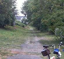
Country Village is enclosed on its southern and western perimeter side by New Jersey Route 440, across from which is Newark Bay. Access to the waterfront is limited due the highway, presenting an obstacle to the development of the Hackensack RiverWalk planned along its shores. The city-line with Bayonne cuts through a small southern part of the neighborhood. The line was originally created along the banks of the Morris Canal, a short filled section of the national historic site running through Country Village as an unmarked, undeveloped, right of way.[1] It creates the official eastern perimeter of the enclave, though the western slope descending from Kennedy Boulevard is somewhat similar in style and character. Danforth Avenue, a major crosstown and commercial street of Greenville, is to the north, its intersection at West Side Avenue marking the origination point of that avenue.[2] To the south are the approaches to two bay crossings, [3] the Newark Bay Bridge and the Lehigh Valley Railroad Bridge.
The neighborhood is in the city's Ward "A"[4] and along with neighboring Bayonne is part of Freeholders District 1.[5]
History
The purpose of the new housing was to offer middle-income urban dwellers an opportunity to buy homes in a residential area with an "out of town" feel without the need for long commutes. In 1959 Jersey City Planning Commission rezoned the 42-acre (170,000 m2) undeveloped industrial tract for residential use. Census figures for the city had revealed a steady decline in the population. (After reaching a height of 316,715 in 1930 and by 1960 the downward trend had reached 276,101.) It was hoped that the creation of new residential districts would increase the population of the city once again. The low-lying area had never been developed because of drainage and sewerage problems. Interested parties in the site were discouraged by the land reclamation requirements for factories to be constructed there. In 1960, however, the builder Alexander Muss took on the task of filling in the lowland area with 400,000 square yards of landfill costing over $500,000. When completed, the 553 houses that cost from $19,000 to $23,000 were reportedly all sold by 1964.[6]
Transportation
- New Jersey Transit buses 10[7] and 129[8] run along Kennedy Boulevard south to Bayonne and north to Journal Square with continuing service via Jersey City Heights to the Port Authority Bus Terminal.[9]
- A&C West Side buses run along West Side Avenue to McGinley Square, Grove Street Station to Newport Centre Mall and Exchange Place.
- New Jersey Transit bus 80[10] along Danforth Avenue and West Side Avenue to Journal Square and Exchange Place.
References
- ↑ JC Online:Morris Canal (Map mentioned in that article)
- ↑ Hudson County New Jersey Street Map. Hagstrom Map Company, Inc. 2008. ISBN 0-88097-763-9.
- ↑ Wikimapia:Newark Bay at Jersey City
- ↑ "JC Ward map". Jerseycityindependent.com. January 6, 2009. Retrieved June 10, 2010.
- ↑ Freeholder District 1, Hudson County, New Jersey. Accessed January 15, 2011.
- ↑ NJCU:Country Village
- ↑ http://www.njtransit.com/pdf/bus/T0010.pdf NJT 10
- ↑ http://www.njtransit.com/pdf/bus/T0119.pdf 119
- ↑ Routes 10/99S schedule
- ↑ NJT 80 schedule
Coordinates: 40°41′57″N 74°06′09″W / 40.699202°N 74.102547°W
