Croftfoot railway station
| Croftfoot | |
|---|---|
|
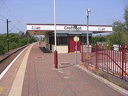
Croftfoot railway station, looking west | |
| Location | |
| Place | Glasgow & Rutherglen |
| Local authority | Glasgow & South Lanarkshire |
| Coordinates | 55°49′06″N 4°13′42″W / 55.8182°N 4.2282°WCoordinates: 55°49′06″N 4°13′42″W / 55.8182°N 4.2282°W |
| Grid reference | NS604605 |
| Operations | |
| Station code | CFF |
| Managed by | Abellio ScotRail |
| Number of platforms | 2 |
|
Live arrivals/departures, station information and onward connections from National Rail Enquiries | |
| Annual rail passenger usage* | |
| 2010/11 |
|
| 2011/12 |
|
| 2012/13 |
|
| 2013/14 |
|
| 2014/15 |
|
| History | |
| Original company | London, Midland and Scottish Railway |
| Post-grouping |
|
| 1 January 1931 | Station opened |
| National Rail – UK railway stations | |
| * Annual estimated passenger usage based on sales of tickets in stated financial year(s) which end or originate at Croftfoot from Office of Rail and Road statistics. Methodology may vary year on year. | |
|
| |
Croftfoot railway station is a railway station that lies directly on the City of Glasgow / South Lanarkshire boundary (the western part in Glasgow and the eastern part being in South Lanarkshire) serving the Croftfoot area of the City of Glasgow and the Spittal and Bankhead areas of the town of Rutherglen, Scotland. The station is managed by Abellio ScotRail and is on the Newton branch of the Cathcart Circle Line.
Services
Every day of the week, there is :[1]
- 2tph to Newton
- 1tph to Glasgow Central via Mount Florida
- 1tph to Glasgow Central via Maxwell Park
| Preceding station | |
Following station | ||
|---|---|---|---|---|
| Burnside | Abellio ScotRail Cathcart Circle |
King's Park | ||
References
- ↑ Table 223 National Rail timetable, May 2016
This article is issued from Wikipedia - version of the 9/12/2016. The text is available under the Creative Commons Attribution/Share Alike but additional terms may apply for the media files.