Cuges-les-Pins
| Cuges-les-Pins | ||
|---|---|---|
|
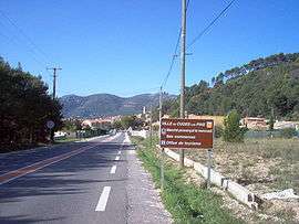
Entrance of Cuges-les-Pins | ||
| ||
 Cuges-les-Pins | ||
|
Location within Provence-A.-C.d'A. region  Cuges-les-Pins | ||
| Coordinates: 43°16′38″N 5°42′05″E / 43.2772°N 5.7014°ECoordinates: 43°16′38″N 5°42′05″E / 43.2772°N 5.7014°E | ||
| Country | France | |
| Region | Provence-Alpes-Côte d'Azur | |
| Department | Bouches-du-Rhône | |
| Arrondissement | Marseille | |
| Canton | Aubagne-Est | |
| Intercommunality | Pays d'Aubagne et de l'Étoile | |
| Government | ||
| • Mayor (2008–2014) | Gilles Aicardi | |
| Area1 | 38.81 km2 (14.98 sq mi) | |
| Population (2008)2 | 4,743 | |
| • Density | 120/km2 (320/sq mi) | |
| Time zone | CET (UTC+1) | |
| • Summer (DST) | CEST (UTC+2) | |
| INSEE/Postal code | 13042 / 13420 | |
| Dialling codes | 0491 | |
| Elevation |
165–1,041 m (541–3,415 ft) (avg. 191 m or 627 ft) | |
|
1 French Land Register data, which excludes lakes, ponds, glaciers > 1 km² (0.386 sq mi or 247 acres) and river estuaries. 2 Population without double counting: residents of multiple communes (e.g., students and military personnel) only counted once. | ||
.svg.png)
Cuges-les-Pins is a commune situated east of Marseille in the department of Bouches-du-Rhône in the Provence-Alpes-Côte d'Azur region in southern France.
Population
| Historical population | ||
|---|---|---|
| Year | Pop. | ±% |
| 1793 | 1,540 | — |
| 1800 | 1,486 | −3.5% |
| 1806 | 1,504 | +1.2% |
| 1821 | 1,735 | +15.4% |
| 1831 | 1,855 | +6.9% |
| 1836 | 1,804 | −2.7% |
| 1841 | 1,709 | −5.3% |
| 1846 | 1,666 | −2.5% |
| 1851 | 1,692 | +1.6% |
| 1856 | 1,603 | −5.3% |
| 1861 | 1,538 | −4.1% |
| 1866 | 1,501 | −2.4% |
| 1872 | 1,450 | −3.4% |
| 1876 | 1,434 | −1.1% |
| 1881 | 1,302 | −9.2% |
| 1886 | 1,260 | −3.2% |
| 1891 | 1,207 | −4.2% |
| 1896 | 1,119 | −7.3% |
| 1901 | 997 | −10.9% |
| 1906 | 935 | −6.2% |
| 1911 | 894 | −4.4% |
| 1921 | 741 | −17.1% |
| 1926 | 808 | +9.0% |
| 1931 | 749 | −7.3% |
| 1936 | 721 | −3.7% |
| 1946 | 754 | +4.6% |
| 1954 | 847 | +12.3% |
| 1962 | 1,109 | +30.9% |
| 1968 | 1,433 | +29.2% |
| 1975 | 1,282 | −10.5% |
| 1982 | 1,875 | +46.3% |
| 1990 | 2,655 | +41.6% |
| 1999 | 3,754 | +41.4% |
| 2008 | 4,743 | +26.3% |
See also
References
External links
- (French) Official town website
| Wikimedia Commons has media related to Cuges-les-Pins. |
This article is issued from Wikipedia - version of the 3/15/2016. The text is available under the Creative Commons Attribution/Share Alike but additional terms may apply for the media files.