Da Qaidam
| Da Qaidam 大柴旦 · ᠶᠡᠬᠡ ᠴᠠᠢᠢᠳᠠᠮ ᠤᠨ · ཚྭ་འདམ་ཆེ་བའི་ | |
|---|---|
| Administrative Zone | |
|
Da Qaidam coach terminal | |
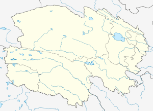
.png) Location of Da Qaidam (red) in Haixi Prefecture (yellow) and Qinghai | |
 Da Qaidam Location of the seat in Qinghai | |
| Coordinates: 37°50′N 95°18′E / 37.833°N 95.300°ECoordinates: 37°50′N 95°18′E / 37.833°N 95.300°E | |
| Country | China |
| Province | Qinghai |
| Autonomous prefecture | Haixi |
| Township-level divisions | 2 towns |
| County seat | Qaidam Town (柴旦镇) |
| Elevation | 3,174 m (10,413 ft) |
| Time zone | China Standard (UTC+8) |
| Website |
hxdcd |

Da Qaidam (simplified Chinese: 大柴旦行政区; traditional Chinese: 大柴旦行政區; pinyin: Dà Cháidàn Xíngzhèngqū) is an Administrative Committee in the northwest of Qinghai province, China, bordering Gansu to the north. It is under the administration of Haixi Mongol and Tibetan Autonomous Prefecture.
Da Qaidam has two subdivisions: the Town of Qaidam (柴旦镇), also called Da Qaidam (大柴旦镇), and the Town of Xitieshan (锡铁山镇). The former is the administrative center of Da Qaidam and has an altitude of 3,174 m (10,413 ft).[1]
China National Highway 215 and China National Highway 315 pass through Da Qaidam and meet here. Yinmaxia railway station and Xitieshan railway station on the Qinghai–Tibet Railway are located in the Administrative Committee of Da Qaidam.[1]
Geography
Da Qaidam borders Delingha to the east, Lenghu to the west, Golmud across Lake Qarhan (察尔汗盐湖) to the south, and Jiuquan (Gansu) to the north, and is part of the northern Qaidam Basin.
Similar to neighbouring Golmud, Da Qaidam has a arid climate (Köppen BWk), with long, cold winters, and warm summers, although due to its location further north and elevation more than 350 metres (1,150 ft) higher than Golmud, its climate is also subalpine in nature. The monthly 24-hour average temperature drops to −13.4 °C (7.9 °F) in January and rises to 15.5 °C (60 °F) in July, while the annual mean is 1.88 °C (35.4 °F). Precipitation is very low, totaling only 83 mm (3.27 in) per annum, falling on 35 days, most of which are during the summer. With monthly percent possible sunshine ranging from 65% in July to 82% in October, the area receives 3,257 hours of bright sunshine annually.
| Climate data for Da Qaidam (1971−2000) | |||||||||||||
|---|---|---|---|---|---|---|---|---|---|---|---|---|---|
| Month | Jan | Feb | Mar | Apr | May | Jun | Jul | Aug | Sep | Oct | Nov | Dec | Year |
| Average high °C (°F) | −4.1 (24.6) |
−0.6 (30.9) |
4.6 (40.3) |
10.4 (50.7) |
15.8 (60.4) |
19.4 (66.9) |
21.8 (71.2) |
21.4 (70.5) |
16.4 (61.5) |
9.7 (49.5) |
2.6 (36.7) |
−2.2 (28) |
9.6 (49.3) |
| Average low °C (°F) | −21.1 (−6) |
−17 (1) |
−10.8 (12.6) |
−5 (23) |
1.2 (34.2) |
6.0 (42.8) |
8.8 (47.8) |
7.7 (45.9) |
2.0 (35.6) |
−6.1 (21) |
−13.6 (7.5) |
−18.7 (−1.7) |
−5.5 (22.0) |
| Average precipitation mm (inches) | 2.1 (0.083) |
1.9 (0.075) |
2.9 (0.114) |
2.3 (0.091) |
8.9 (0.35) |
21.4 (0.843) |
21.8 (0.858) |
14.4 (0.567) |
4.7 (0.185) |
0.8 (0.031) |
0.6 (0.024) |
1.2 (0.047) |
83.0 (3.268) |
| Average precipitation days (≥ 0.1 mm) | 2.5 | 2.0 | 2.0 | 1.6 | 3.1 | 5.8 | 7.5 | 4.8 | 2.5 | 0.7 | 0.7 | 1.5 | 34.7 |
| Average relative humidity (%) | 44 | 35 | 30 | 27 | 30 | 37 | 40 | 37 | 34 | 30 | 35 | 40 | 34.9 |
| Mean monthly sunshine hours | 233.8 | 225.9 | 267.7 | 290.2 | 315.3 | 293.0 | 293.2 | 297.7 | 278.2 | 285.4 | 246.4 | 230.6 | 3,257.4 |
| Percent possible sunshine | 77 | 75 | 73 | 74 | 72 | 67 | 65 | 71 | 75 | 82 | 81 | 78 | 74.2 |
| Source: China Meteorological Administration | |||||||||||||
Economy
As elsewhere in the Qaidam Basin, mining industries are of major importance in Da Qaidam. There is a lead mine in Xitieshan (锡铁山铅矿; 37°19′00″N 95°34′00″E / 37.31667°N 95.56667°E), as well as a number of salt lakes where potash and related products are extracted.