Hainan Tibetan Autonomous Prefecture
Not to be confused with Hainan Province.
| Hainan Prefecture 海南州 · མཚོ་ལྷོ་ཁུལ། | |
|---|---|
| Autonomous prefecture | |
海南藏族自治州 · མཚོ་ལྷོ་བོད་རིགས་རང་སྐྱོང་ཁུལ | |
| Chinese transcription(s) | |
| • Chinese character | 海南藏族自治州 |
| • Hanyu Pinyin | Hǎinán Zàngzú Zìzhìzhōu |
| Tibetan transcription(s) | |
| • Tibetan script | མཚོ་ལྷོ་བོད་རིགས་རང་སྐྱོང་ཁུལ |
| • Wylie | mtsho-lho bod-rigs rang-skyong-khul |
| • Tibetan pinyin | Colho Poirig Ranggyong Kü |
|
| |
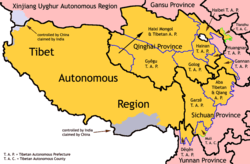
 Location of Hainan Prefecture in Qinghai | |
| Country | People's Republic of China |
| Province | Qinghai |
| Prefecture seat | Gonghe County (Qabqa) |
| Time zone | China Standard (UTC+8) |
| Website | http://www.qhhn.gov.cn/ |
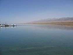
Hainan Tibetan Autonomous Prefecture (Chinese: 海南藏族自治州; Tibetan: མཚོ་ལྷོ་བོད་རིགས་རང་སྐྱོང་ཁུལ་ ) is an autonomous prefecture of northeastern Qinghai Province in Western China. The prefecture has an area of 45,895 square kilometres (17,720 sq mi) and its seat is located in Gonghe County. Its name literally means "south of (Qinghai) Lake."
Demographics
According to the 2000 census, the prefecture has 375,426 inhabitants with a population density of 8.18 inhabitants/km².
The following is a list of ethnic groups in the prefecture, as of the 2000 census.
| Ethnicity | Population | Percentage |
|---|---|---|
| Tibetan | 235,663 | 62.77% |
| Han | 105,337 | 28.06% |
| Hui | 26,152 | 6.97% |
| Tu | 3,750 | 1% |
| Mongol | 2.637 | 0.7% |
| Salar | 1,231 | 0.33% |
| Others | 656 | 0.17% |
Subdivisions
The prefecture is subdivided into 5 county-level divisions (5 counties):
| Map | ||||||||
|---|---|---|---|---|---|---|---|---|
 | ||||||||
| # | Name | Hanzi | Hanyu Pinyin | Tibetan | Wylie Tibetan Pinyin |
Population (2010 Census) |
Area (km²) | Density (/km²) |
| 1 | Gonghe County | 共和县 | Gònghé Xiàn | གསེར་ཆེན་རྫོང་ | gser chen rdzong Gêrqên Zong |
122,966 | 16,050 | 7.66 |
| 2 | Tongde County | 同德县 | Tóngdé Xiàn | འབའ་རྫོང་ | 'ba' rdzong Pa Zong |
64,369 | 6,494 | 9.91 |
| 3 | Guide County | 贵德县 | Guìdé Xiàn | ཁྲི་ཀ་རྫོང་ | thri ka rdzong Triga Zong |
101,771 | 3,600 | 28.26 |
| 4 | Xinghai County | 兴海县 | Xīnghǎi Xiàn | བྲག་དཀར་རྫོང་ | brag dkar rdzong Zhag'gar Zong |
76,025 | 13,158 | 5.77 |
| 5 | Guinan County | 贵南县 | Guìnán Xiàn | མང་རྫོང་ | mang rdzong Mang Zong |
76,560 | 6,593 | 11.61 |
Further reading
- A. Gruschke: The Cultural Monuments of Tibet’s Outer Provinces: Amdo - Volume 1. The Qinghai Part of Amdo, White Lotus Press, Bangkok 2001. ISBN 974-480-049-6
- Tsering Shakya: The Dragon in the Land of Snows. A History of Modern Tibet Since 1947, London 1999, ISBN 0-14-019615-3
External links
Coordinates: 36°17′N 100°37′E / 36.29°N 100.62°E
This article is issued from Wikipedia - version of the 8/19/2016. The text is available under the Creative Commons Attribution/Share Alike but additional terms may apply for the media files.

