Derby Parish, New Brunswick
| Derby | |
|---|---|
| Parish | |
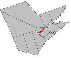 Location within Northumberland County, New Brunswick | |
| Coordinates: 46°53′15″N 65°39′18″W / 46.8875°N 65.655°W | |
| Country |
|
| Province |
|
| County | Northumberland |
| Established | 1859 |
| Area[1] | |
| • Land | 61.01 km2 (23.56 sq mi) |
| Population (2011)[1] | |
| • Total | 998 |
| • Density | 16.4/km2 (42/sq mi) |
| • Pop 2006-2011 |
|
| • Dwellings | 466 |
| Time zone | AST (UTC-4) |
| • Summer (DST) | ADT (UTC-3) |
Derby is a Canadian parish in Northumberland County, New Brunswick.[2]
Its population in the 2011 Census was 998.
History
Derby Parish was erected from Nelson Parish in 1859: named for Edward George Geoffrey Smith Stanley (1799-1869), the 14th Earl of Derby and Prime Minister of the United Kingdom.
Delineation
Derby Parish is defined in the Territorial Division Act[3] as being bounded:
- West by Blackville Parish, north by Southesk Parish and the Northwest Miramichi River east by the lower extremity of Beaubears Island and to include the same, and south by the southwest branch of the Miramichi River.
Communities
Parish population total does not include incorporated municipalities (in bold) and communities within their respective boundaries (in italics).
|
|
Bodies of water and islands
This is a list of rivers, lakes, streams, creeks, marshes and Islands that are at least partially in this parish.
Demographics
PopulationPopulation trend[4]
|
LanguageMother tongue language (2006)[5]
|
Access routes
Highways and numbered routes that run through the parish, including external routes that start or finish at the parish limits:[6]
See also
References
- 1 2 2011 Statistics Canada Census Profile: Derby Parish, New Brunswick
- ↑ New Brunswick Provincial Archives - Derby Parish
- ↑ "Territorial Division Act (R.S.N.B. 1973, c. T-3)". Government of New Brunswick website. Retrieved 18 August 2016.
- ↑ Statistics Canada: 1996, 2001, 2006 census
- ↑ 2006 Statistics Canada Community Profile: Derby Parish, New Brunswick
- ↑ Atlantic Canada Back Road Atlas ISBN 978-1-55368-618-7
 |
Southesk Parish | | ||
| Blackville Parish | |
Chatham Parish | ||
| ||||
| | ||||
| Nelson Parish |
| Subdivisions | |
|---|---|
| Cities | |
| Counties | |
| |
Coordinates: 46°53′15″N 65°39′18″W / 46.88750°N 65.65500°W