Northumberland County, New Brunswick
| Northumberland | |
|---|---|
| County | |
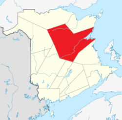 Location within New Brunswick. | |
| Country |
|
| Province |
|
| Established | 1785 |
| Area[1] | |
| • Land | 12,932.70 km2 (4,993.34 sq mi) |
| Population (2011)[1] | |
| • Total | 48,355 |
| • Density | 3.7/km2 (10/sq mi) |
| • Pop 2006-2011 |
|
| • Dwellings | 22,078 |
| Time zone | AST (UTC-4) |
| • Summer (DST) | ADT (UTC-3) |
| Area code(s) | 506 |
| Wikimedia Commons has media related to Northumberland County, New Brunswick. |
Northumberland County (2011 population 48,355), having the largest area of any county in the province, is located in northeastern New Brunswick, Canada.[2]
Geography
Northumberland County is covered by thick forests, whose products stimulate the economy. The highest peaks in the province, including Mount Carleton lie in the northwestern corner of the county.
The county is dominated by the Miramichi River, world famous for its salmon fishing. The lower portion of the river is an estuary which widens into Miramichi Bay, a part of the Gulf of St. Lawrence.
Services
The city of Miramichi is a local service centre for the county and surrounding regions with schools, hospitals and government offices and retail locations. The county has several saw mills in the city of Miramichi and up the Southwest Branch of the Miramichi River. There were formerly two large pulp and paper mills at Miramichi.
Chatham was also home to an air force base, CFB Chatham, until 1996. Renous-Quarryville, located along the Southwest Miramichi was also home to an army post - a federal maximum security penitentiary is now located on the site.
Census subdivisions
Communities
There are five municipalities within the county (listed by 2011 population):[1]
| Official Name | Designation | Area km2 | Population | Parish |
|---|---|---|---|---|
| Miramichi | City | 179.84 | 17,811 | Nelson Newcastle |
| Neguac | Village | 26.69 | 1,678 | Alnwick |
| Rogersville | Village | 7.23 | 1,170 | Rogersville |
| Blackville | Village | 21.73 | 990 | Blackville |
| Doaktown | Village | 28.74 | 793 | Blissfield |
First Nations
There are five First Nations reservations in Northumberland County (listed by 2011 population):[1]
| Official Name | Designation | Area km2 | Population | Parish |
|---|---|---|---|---|
| Esgenoôpetitj 14 | Reservation | 9.54 | 1,046 | Alnwick |
| Eel Ground 2 | Reservation | 10.90 | 448 | Northesk |
| Red Bank 4 | Reservation | 16.18 | 352 | Southesk |
| Big Hole Tract 8 (South) | Reservation | 27.82 | 34 | Northesk |
| Tabusintac 9 | Reservation | 22.00 | 10 | Alnwick |
Three communities in the county are part of the Mi'kmaq Nation: Metepenagiag Mi'kmaq Nation, at the junction of the Northwest Miramichi River and the Little Southwest Miramichi River; Eel Ground First Nation, close to the junction of the Northwest and Southwest Miramichi Rivers near Newcastle; and Burnt Church First Nation on the northern shore of Miramichi Bay.
Parishes
The county is subdivided into thirteen parishes (listed by 2011 population):[1]
| Official Name | Area km2 | Population | Municipalities | Unincorporated communities |
|---|---|---|---|---|
| Alnwick | 734.57 | 5,922 | Neguac (village) Esgenoôpetitj 14 (reserve) Tabusintac 9 (reserve) |
Barryville / Oak Point-Bartibog Bridge / Bayshore / Blacklands / Brantville / Breau Road / Burnt Church / Cains Point / Christies Landing / Covedell / Drisdelle Settlement / Fairisle / Gaythorne / Lagacéville / Lauvergot / Lavillette / Lower Bartibogue / Old Dans Landing / Pontgravé / Price Settlement / Rivière-des-Caches / Rivière-du-Portage / Robichaud Settlement / Saint-Wilfred / Sheldrake Island / Stymiest Road / Tabusintac / The Willows / Village-Saint-Laurent / Winston / Wishart Point |
| Northesk | 3,352.99 | 2,352 | Eel Ground 2 (reservation) Big Hole Tract 8 (reservation) |
Bear House / Big Hole / Boom Road / Chaplin Island Road / Curtis Settlement / Curventon / Eel Ground / Exmoor / Heath Steele / Indian Falls Depot / Lumsden Road / Maple Glen / Mathias Landing / North Esk Boom / Popple Depot / Redstone Rapids / Sevogle / Strathadam / Sunny Corner / Trout Brook / Wayerton / Whitney |
| Hardwicke | 278.60 | 2,329 | Auburnville / Baie-Sainte-Anne / Bay du Vin / Bay du Vin Beach / Eel River Bridge / Escuminac / Fox Island / Gregan / Hardwicke / Hardwood Settlement / Hortons Creek / Manuels / Point Gardiner / Vin Island | |
| Blackville | 823.40 | 2,215 | Blackville (village) | Barnett / Barnettville / Hardscramble / Keenan Siding / Lockstead / Smith Crossing / Shinnickburn |
| Southesk | 2,459.43 | 1,833 | Red Bank 4 (reservation) | Cassilis / Dennis / Garden Road / Halcomb / Harris Brook Settlement / Loggie Lodge / Lyttleton / Maple Hill / Matthews / Pratts Camp / Ramsay Lodge / Red Bank / Red Rock / Sillikers / South Esk / Warwick Settlement / Williamstown |
| Glenelg | 504.80 | 1,610 | Bay du Vin Mills / Black River Bridge / Centre Napan / Fowlies Mill / Glenwood / Little Branch / Lower Napan / McKenzie Settlement / Napan Bay / Point aux Carr / Redmondville / St. Margarets / Victoria / Wine River | |
| Ludlow | 1,016.66 | 1,568 | Carrolls Crossing / Ludlow / McNamee / Porter Cove / Priceville | |
| Newcastle | 577.47 | 1,220 | Miramichi (city) | Bartibog / Beaver Brook Station / Bellefond / Beveridge / Busby / East Beaver Brook / Elizabethton / Highbank / Little Bartibog / Lower Newcastle-Russellville / McEwan Dam / Morrissy / Patterson Siding / Patterson Station / Telly Road Crossing |
| Rogersville | 326.36 | 1,213 | Rogersville (village) | Collette / East Collette / Lakeland / Marcelville / Murray Settlement / North Rogersville / Pleasant Ridge / Regneautville / Rosaireville / Sapin-Court / Shediac Ridge / St. Bernard / Vienneau / West Collette / Young Ridge |
| Derby | 61.02 | 998 | Bryenton / Davidson, New Brunswick / Derby / Derby Junction / Elmtree / Lower Derby / Manderville / Millerton / Northwest Bridge / Parker Road / Renous-Quarryville / South Nelson Road / Upper Derby | |
| Nelson | 353.80 | 935 | Miramichi (city) | Barnaby River / Chelmsford / Doyles Brook / Hughes / Kirkwood / Lower Barnaby / McKinleyville / Passmore / Semiwagan Ridge / Upper Barnaby |
| Chatham | 22.26 | 522 | Lower Napan / Middle Island / Savoy Beach / Snyders Beach / Upper Napan | |
| Blissfield | 1,240.26 | 501 | Doaktown (village) | Amostown / O'Donnelltown / Storeytown |
Demographics
The county is a mostly English speaking region in the otherwise Francophone northeastern New Brunswick. Coastal regions of Miramichi Bay are Acadian. The former town of Chatham has traditionally been an Irish stronghold, while its sister town of Newcastle has had a more English and Scottish Protestant flavour. Both are now amalgamated into the new city of Miramichi.
Population
| Canada census – Northumberland County, New Brunswick community profile | |||
|---|---|---|---|
| 2011 | 2006 | 2001 | |
| Population: | 48,355 (-2.7% from 2006) | 48,868 (-3.8% from 2001) | 50,817 (-2.6% from 1996) |
| Land area: | 12,932.70 km2 (4,993.34 sq mi) | 12,112.45 km2 (4,676.64 sq mi) | 12,112.44 km2 (4,676.64 sq mi) |
| Population density: | 3.7/km2 (9.6/sq mi) | 4.0/km2 (10/sq mi) | 4.2/km2 (11/sq mi) |
| Median age: | 46.4 (M: 45.5, F: 47.1) | 42.5 (M: 41.8, F: 43.2) | 38.9 (M: 38.1, F: 39.7) |
| Total private dwellings: | 22,078 | 21,115 | 20,875 |
| Median household income: | $47,858 | $40,166 | $36,513 |
| References: 2011[1] 2006[3] 2001[4] | |||
| Historical Census Data - Northumberland County, New Brunswick[5] | |||||||||||||||||||||||||||||
|---|---|---|---|---|---|---|---|---|---|---|---|---|---|---|---|---|---|---|---|---|---|---|---|---|---|---|---|---|---|
|
|
| |||||||||||||||||||||||||||
(A) adjustment due to boundary change. | |||||||||||||||||||||||||||||
Language
| Canada Census Mother Tongue - Northumberland County, New Brunswick[5] | ||||||||||||||||||
|---|---|---|---|---|---|---|---|---|---|---|---|---|---|---|---|---|---|---|
| Census | Total | English |
French |
English & French |
Other | |||||||||||||
| Year | Responses | Count | Trend | Pop % | Count | Trend | Pop % | Count | Trend | Pop % | Count | Trend | Pop % | |||||
| 2011 |
47,425 |
33,750 | |
71.16% | 12,155 | |
25.63% | 405 | |
0.85% | 1,115 | |
2.35% | |||||
| 2006 |
48,185 |
33,775 | |
70.09% | 12,670 | |
26.29% | 225 | |
0.47% | 1,515 | |
3.14% | |||||
| 2001 |
50,155 |
35,090 | |
69.96% | 13,535 | |
26.99% | 380 | |
0.76% | 1,150 | |
2.29% | |||||
| 1996 |
51,390 |
36,420 | n/a | 70.87% | 13,825 | n/a | 26.90% | 370 | n/a | 0.72% | 775 | n/a | 1.51% | |||||
Access Routes
Highways and numbered routes that run through the county, including external routes that start or finish at the county limits:[6]
|
Protected areas and attractions
Notable people
See also
References
- 1 2 3 4 5 6 2011 Statistics Canada Census Profile: Northumberland County, New Brunswick
- ↑ New Brunswick Provincial Archives - Northumberland County
- ↑ "2006 Community Profiles". Canada 2006 Census. Statistics Canada. March 30, 2011. Retrieved 2014-03-27.
- ↑ "2001 Community Profiles". Canada 2001 Census. Statistics Canada. February 17, 2012. Retrieved 2014-03-27.
- 1 2 Statistics Canada: 1996, 2001, 2006, 2011 census
- ↑ Atlantic Canada Back Road Atlas ISBN 978-1-55368-618-7
External links
 |
Restigouche County | Gloucester County | | |
| Victoria County | |
Gulf of Saint Lawrence | ||
| ||||
| | ||||
| York County | Sunbury County / Queens County | Kent County |
| Subdivisions | |
|---|---|
| Cities | |
| Counties | |
| |
Coordinates: 47°02′N 65°35′W / 47.033°N 65.583°W