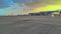
Diyarbakır Airport
| Diyarbakır Airport Diyarbakır Havalimanı | |||||||||||
|---|---|---|---|---|---|---|---|---|---|---|---|
 | |||||||||||
| IATA: DIY – ICAO: LTCC | |||||||||||
| Summary | |||||||||||
| Airport type | Public/Military | ||||||||||
| Owner | Turkish Air Force | ||||||||||
| Operator |
DHMİ (State Airports Administration) 8th Air Wing, 2nd Air Force Command | ||||||||||
| Location | Diyarbakır, Turkey | ||||||||||
| Elevation AMSL | 686 m / 2,251 ft | ||||||||||
| Coordinates | 37°53′38″N 040°12′03″E / 37.89389°N 40.20083°ECoordinates: 37°53′38″N 040°12′03″E / 37.89389°N 40.20083°E | ||||||||||
| Website |
diyarbakir | ||||||||||
| Map | |||||||||||
 DIY Location of airport in Turkey | |||||||||||
| Runways | |||||||||||
| |||||||||||
Diyarbakır Airport (IATA: DIY, ICAO: LTCC) is a military airbase and public airport located in Diyarbakır, Turkey.
Overview
Diyarbakır Airport is home to the 8th Air Wing (Ana Jet Üs or AJÜ) of the 2nd Air Force Command (Hava Kuvvet Komutanligi) of the Turkish Air Force (Türk Hava Kuvvetleri). Other wings of this command are located in Merzifon (LTAP), Malatya Erhaç (LTAT) and İncirlik (LTAG).[4]
The airport was closed for renovation from 1 June to 1 September 2012. All air traffic was diverted to Batman, Mardin and Elazığ.
In 2012, an Armenian American named Zuart Sudjian, claiming that she held the land deed to the property of the airport and owned the right of its inheritance. She filed a lawsuit through her lawyer Ali Elbeyoğlu for the return of the lands. After a rejection by a local court, the case was taken to the Court of Cassation where the verdict is being appealed.[5]
The Air Base is used by the 1st Expeditionary Rescue Group of the United States Air Force as part of Operation Inherent Resolve.
Airlines and destinations
| Airlines | Destinations |
|---|---|
| Borajet | Adana |
| Onur Air | Istanbul-Atatürk, Nicosia-Ercan |
| Pegasus Airlines | Ankara, Istanbul-Sabiha Gökçen, Izmir |
| SunExpress | Antalya, Izmir |
| Turkish Airlines | Erbil, Istanbul-Atatürk |
| Turkish Airlines operated by AnadoluJet | Ankara, Bursa, Istanbul-Sabiha Gökçen |
Traffic Statistics
| Year (months) | Domestic | % change | International | % change | Total | % change |
|---|---|---|---|---|---|---|
| 2015 | 2,085,114 | 15,087 | 2,100,201 | |||
| 2014 | 1,796,067 | 16,141 | 1,812,208 | |||
| 2013 | 1,782,827 | 15,826 | 1,798.653 | |||
| 2012 | 1,270,613 | 15,211 | 1,285,824 | |||
| 2011 | 1,714,423 | 18,951 | 1,733,374 | |||
| 2010 | 1,390,165 | 14,425 | 1,404,590 | |||
| 2009 | 1,048,875 | 11,506 | 1,060,381 | |||
| 2008 | 949,668 | 17,420 | 967,088 | |||
| 2007 | 881,278 | - | 14,347 | - | 895,625 | - |
(*)Source: DHMI.gov.tr[6]
Incidents
On January 8, 2003, Turkish Airlines Flight 634, crashed on approaching Diyarbakır Airport. 75 of the 80 passengers and crew on board were killed.
On August 27, 2016, several rockets were fired at the airport.[7]
References
- ↑ (Turkish) Diyarbakır Hava Meydanı at DHMİ (State Airports Authority)
- ↑ Airport information for LTCC at World Aero Data. Data current as of October 2006.Source: DAFIF.
- ↑ Airport information for LTCC at Great Circle Mapper. Source: DAFIF (effective October 2006).
- ↑ Turkish Air Force - Scramble
- ↑ Gültekin, Uygar (31 December 2014). "Landing Diyarbakır Airport on the Basmacıyans' land". Agos.
- ↑ Statistics
- ↑ "Rockets hit airport in Turkey's southeast – reports". rt.com. Russia Today. Retrieved August 27, 2016.
External links
- Accident history for DIY at Aviation Safety Network
- Airport information for LTCC at Great Circle Mapper.
- Current weather for LTCC at NOAA/NWS
- Airport information for LTCC at World Aero Data. Data current as of October 2006.