Douglas, Georgia
| Douglas, Georgia | |
|---|---|
| City | |
|
Douglas City Hall | |
| Motto: Working Together to Serve You Better | |
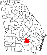
 Location in Coffee County and the state of Georgia | |
| Coordinates: 31°30′27″N 82°51′3″W / 31.50750°N 82.85083°WCoordinates: 31°30′27″N 82°51′3″W / 31.50750°N 82.85083°W | |
| Country | United States |
| State | Georgia |
| County | Coffee |
| Government | |
| • City Mayor | James Dennis |
| • City Manager | Terrel Jacobs |
| Area | |
| • Total | 14.0 sq mi (36.2 km2) |
| • Land | 13.4 sq mi (34.7 km2) |
| • Water | 0.6 sq mi (1.5 km2) |
| Elevation | 253 ft (77 m) |
| Population (2010) | |
| • Total | 11,589 |
| • Density | 866/sq mi (334.2/km2) |
| Time zone | EST (UTC-5) |
| • Summer (DST) | EDT (UTC-4) |
| ZIP codes | 31533-31535 |
| Area code(s) | 912 |
| FIPS code | 13-23872[1] |
| GNIS feature ID | 0313591[2] |
| Website |
www |

Douglas is a city in Coffee County, Georgia, United States. As of the 2010 census, the city had a population of 11,589.[3] Douglas is the county seat of Coffee County[4] and the core city of the Douglas, Georgia Micropolitan Statistical Area, which had a population of 50,731 as of the 2010 census.[5]
History
Douglas was founded in 1855 as the seat of the newly formed Coffee County.[6] It was named for Senator Stephen A. Douglas from Illinois, a renowned stump speaker who was the challenger to Abraham Lincoln in the presidential election of 1860.
Douglas was chartered as a town in 1895 and as a city in 1897. In 1895, the railroad came to Douglas and the community began to boom.[7] In 1909, the Georgia and Florida Railway located its offices in Douglas.
The Eleventh District Agricultural & Mechanical School was established in Douglas in 1906. In 1927, South Georgia College was founded as Georgia's first state-supported junior college.
During the 1920s and 1930s, Douglas was one of the major tobacco markets in the state. Much of this history is depicted in the Heritage Station Museum, located in the former Georgia and Florida Railway train station on Ward Street in downtown Douglas.
Douglas has two areas listed on the National Register of Historic Places: the downtown and Gaskin Avenue historic districts. They were added to the list in 1989.[8]
Geography
Douglas is located near the center of Coffee County at 31°30′27″N 82°51′3″W / 31.50750°N 82.85083°W (31.507413, -82.850799).[9] It is 59 miles (95 km) driving distance northeast of Valdosta, Georgia, 115 miles (185 km) driving distance northwest of Jacksonville, Florida, and 201 miles (323 km) driving distance southeast of Atlanta.
According to the United States Census Bureau, Douglas has a total area of 14.0 square miles (36.2 km2), of which 13.4 square miles (34.7 km2) is land and 0.58 square miles (1.5 km2), or 4.08%, is water.[10] Major water bodies include Twenty Mile Creek, the Seventeen Mile River (a tributary of the Satilla River), and Hilliard's Pond, which was once the ski show park "Holiday Beach".
Demographics
| Historical population | |||
|---|---|---|---|
| Census | Pop. | %± | |
| 1900 | 617 | — | |
| 1910 | 3,550 | 475.4% | |
| 1920 | 3,401 | −4.2% | |
| 1930 | 426 | −87.5% | |
| 1940 | 5,175 | 1,114.8% | |
| 1950 | 7,428 | 43.5% | |
| 1960 | 8,736 | 17.6% | |
| 1970 | 10,195 | 16.7% | |
| 1980 | 10,980 | 7.7% | |
| 1990 | 10,464 | −4.7% | |
| 2000 | 10,639 | 1.7% | |
| 2010 | 11,589 | 8.9% | |
| Est. 2015 | 11,718 | [11] | 1.1% |
As of the census[1] of 2000, there were 10,639 people, 3,977 households, and 2,656 families residing in the city. The population density was 825.7 people per square mile (318.9/km²). There were 4,692 housing units at an average density of 364.2 per square mile (140.7/km²). The racial makeup of the city was 48.41% White, 45.33% African American, 0.27% Native American, 1.09% Asian, 0.05% Pacific Islander, 3.80% from other races, and 1.05% from two or more races. Hispanic or Latino of any race were 6.92% of the population.
There were 3,977 households out of which 32.5% had children under the age of 18 living with them, 41.3% were married couples living together, 21.3% had a female householder with no husband present, and 33.2% were non-families. 28.3% of all households were made up of individuals and 12.8% had someone living alone who was 65 years of age or older. The average household size was 2.57 and the average family size was 3.14.
In the city the population was spread out with 27.8% under the age of 18, 11.6% from 18 to 24, 26.3% from 25 to 44, 19.8% from 45 to 64, and 14.5% who were 65 years of age or older. The median age was 33 years. For every 100 females there were 83.9 males. For every 100 females age 18 and over, there were 77.0 males.
The median income for a household in the city was $27,946, and the median income for a family was $36,349. Males had a median income of $26,551 versus $20,145 for females. The per capita income for the city was $15,652. About 17.9% of families and 24.4% of the population were below the poverty line, including 31.2% of those under age 18 and 22.0% of those age 65 or over.
Douglas Micropolitan Statistical Area

Douglas is the principal city of the Douglas Micropolitan Statistical Area, a micropolitan area that covers Atkinson and Coffee counties[13] and had a combined population of 50,731 at the 2010 census.[5]
Infrastructure
Highways
 U.S. Route 221 (runs north-south)
 U.S. Route 441 (runs north-south)
 Georgia State Route 31 (runs north-south)
 Georgia State Route 32 (runs east-west)
 Georgia State Route 135 (runs north-south)
 Georgia State Route 158 (runs east-west)
 Georgia State Route 206 (runs east-west)
Airport
Utilities
- The Electric Department, locally owned and a member of Municipal Electric Authority of Georgia, services Douglas with power.[14]
- The Natural Gas Department, member of both Georgia & American Public Gas Association and the Municipal Gas Authority of Georgia, provides gas to the area.[15]
- Water and sewer service is conducted by the city's Water Department.[16]
- The Public Works Department handles yard clippings, junk items, and animal control for the city.[17]
Economy
Major employers
AgricultureFarming plays a large role in the area's economy. Major agricultural products from the town and surrounding county include peanuts, corn, tobacco, and cotton. Chicken is also a major part of the economy.[18] TourismDouglas is home to Heritage Station Museum, which displays artifacts of the city's history. The World War II Flight Training Museum (the old 63rd Army Air Forces Contract Pilot School), Broxton Rocks, and the Ashley-Slater House are also popular tourist attractions in the area. All three were recently named among "Georgia's Hidden Treasures" in a segment on WSB-TV. Douglas has ten public parks that offer year-round activities for all ages and interest groups. There are four golf courses in and around the city. Nearby, the 1,490 acres (6.0 km2) General Coffee State Park draws more than 100,000 visitors a year and is the most popular tourist attraction in the area. Healthcare
Media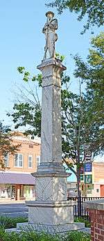 Confederate soldier memorial
EducationCoffee County School DistrictThe Douglas-Coffee County area is served by the Coffee County Board of Education. The Coffee County School District holds pre-school to grade twelve, and consists of eight elementary schools, a middle school, three high schools, and an alternative education center.[19] The district has 438 full-time teachers and over 8,000 students.[20]
Private schools
Higher education
Notable people
See alsoReferences
External links
| |||||||||||||||||