Drumraney (civil parish)
| Drumraney Droim Raithne | |
|---|---|
| Civil parish | |
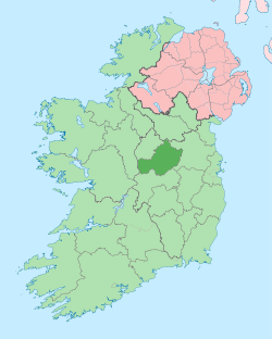
 Drumraney Location of Drumraney within County Westmeath in the Republic of Ireland | |
| Coordinates: 53°28′19″N 7°45′34″W / 53.47194°N 7.75944°WCoordinates: 53°28′19″N 7°45′34″W / 53.47194°N 7.75944°W | |
| Country |
|
| Province | Leinster |
| County | County Westmeath |
| Irish grid reference | N160468 |
Drumraney (Irish: Droim Raithne)[1] is a civil parish in County Westmeath, Ireland. It is located about 28.08 kilometres (17 mi) west of Mullingar.
Drumraney is one of 4 civil parishes in the barony of Kilkenny West in the Province of Leinster. The civil parish covers 9,108.5 acres (36.861 km2).
Drumraney civil parish comprises the village of Drumraney and 40 townlands: Ardborra, Ardbuckan, Ardnagragh, Ardnagragh Digby, Ardnagragh Gray, Ballycloghduff, Ballycloghduff (Molston), Ballynalone, Ballysallagh, Baskin High, Baskin Low, Bleachlawn, Bryanmore Lower, Bryanmore Upper, Byanbeg Lower, Byanbeg Upper, Carrickaneha, Cartroncoragh, Cauran, Cloghbreen, Cormaclew, Corr, Curraghbane, Curraghroodle, Drumraney, Dunnamona, Fairfield, Fearmore, Fearmore, Kilcornan, Killeennanam, Killininneen, Kiltober, Lissanode, Newgrove, Oldtown or Puddingstreet, Pishanagh, Streamstown, Toorbeg and Walderstown.
The neighbouring civil parishes are: Noughaval to the north, Ballymore to the east, Ballyloughloe to the south and Kilkenny West to the west.[2][3][1]
References
- 1 2 Noughaval civil parish The Placenames Database of Ireland. Retrieved on 28 July 2015.
- ↑ Drumraney civil parish, Co. Westmeath townlands.ie Retrieved on 28 July 2015.
- ↑ Drumraney civil parish, Co. Westmeath The IreAtlas Townland Data Base. Retrieved on 28 July 2015.
External links
- Drumraney civil parish at the IreAtlas Townland Data Base
- Drumraney civil parish at townlands.ie
- Drumraney civil parish at The Placenames Database of Ireland