Drumcree, County Westmeath
| Druim Criadh Drumcree | |
|---|---|
| Town | |
|
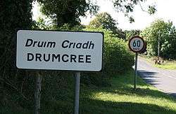
Entering Druim Criadh, facing west towards Granard | |
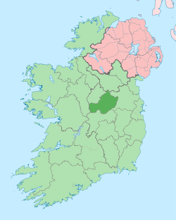
 Druim Criadh Location in Ireland | |
| Coordinates: 53°38′50″N 7°12′30″W / 53.64722°N 7.208201°WCoordinates: 53°38′50″N 7°12′30″W / 53.64722°N 7.208201°W | |
| Country | Ireland |
| Province | Leinster |
| County | County Westmeath |
| Elevation | 118 m (387 ft) |
| Population (2006) | |
| • Urban | 326 |
| • Rural | 355 |
| Time zone | WET (UTC+0) |
| • Summer (DST) | IST (WEST) (UTC-1) |
| Irish Grid Reference | N500673 |
| Website |
www |
Druim Criadh (anglicised as Drumcree) is a small village in County Westmeath in Ireland on the R395 regional road. This village is part of St Mary's Parish, Collinstown, and a sister parish of St Feichin's, Fore.
The village is situated upon a crossroads, fringes parts of the Barbavilla Bog, the Glackstown Bog, and Mullacruaigh bog, all of which have been harvested for winter fuel for generations by the neighbouring communities.
This article is issued from Wikipedia - version of the 3/17/2013. The text is available under the Creative Commons Attribution/Share Alike but additional terms may apply for the media files.