Du Pont, Georgia
| Du Pont, Georgia | |
|---|---|
| Town | |
|
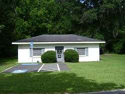
Du Pont Town Hall | |
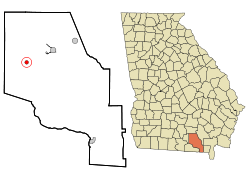 Location in Clinch County and the state of Georgia | |
| Coordinates: 30°59.4′N 82°52.3′W / 30.9900°N 82.8717°WCoordinates: 30°59.4′N 82°52.3′W / 30.9900°N 82.8717°W | |
| Country | United States |
| State | Georgia |
| County | Clinch |
| Area | |
| • Total | 0.8 sq mi (2.0 km2) |
| • Land | 0.8 sq mi (2.0 km2) |
| • Water | 0 sq mi (0 km2) |
| Elevation | 184 ft (56 m) |
| Population (2010) | |
| • Total | 120 |
| • Density | 153/sq mi (59.2/km2) |
| Time zone | Eastern (EST) (UTC-5) |
| • Summer (DST) | EDT (UTC-4) |
| ZIP code | 31630 |
| Area code(s) | 912 |
| FIPS code | 13-24796[1] |
| GNIS feature ID | 0355562[2] |
Du Pont is a town in Clinch County, Georgia, United States. The population was 120 at the 2010 census.[3]
According to the 1916 History of Clinch County the town was first settled around 1856 as Lawton, but was renamed in 1874 after J. P. A. DuPont, an early settler. It was incorporated as a city in 1889.
Geography
Du Pont is located in northwestern Clinch County at 30°59.4′N 82°52.3′W / 30.9900°N 82.8717°W (30.9896, -82.8707).[4] U.S. Route 84 passes through the center of the town, leading east 8 miles (13 km) to Homerville, the county seat, and west 8 miles (13 km) to Stockton.
According to the United States Census Bureau, Du Pont has a total area of 0.8 square miles (2.1 km2), all of it land.
Demographics
| Historical population | |||
|---|---|---|---|
| Census | Pop. | %± | |
| 1910 | 342 | — | |
| 1920 | 381 | 11.4% | |
| 1930 | 372 | −2.4% | |
| 1940 | 332 | −10.8% | |
| 1950 | 285 | −14.2% | |
| 1960 | 210 | −26.3% | |
| 1970 | 252 | 20.0% | |
| 1980 | 267 | 6.0% | |
| 1990 | 177 | −33.7% | |
| 2000 | 139 | −21.5% | |
| 2010 | 120 | −13.7% | |
| Est. 2015 | 124 | [5] | 3.3% |
As of the census[1] of 2000, there were 139 people, 57 households, and 42 families residing in the town. The population density was 176.8 people per square mile (67.9/km²). There were 62 housing units at an average density of 78.8 per square mile (30.3/km²). The racial makeup of the town was 61.87% White and 38.13% African American. Hispanic or Latino of any race were 2.16% of the population.
There were 57 households out of which 31.6% had children under the age of 18 living with them, 54.4% were married couples living together, 17.5% had a female householder with no husband present, and 24.6% were non-families. 24.6% of all households were made up of individuals and 10.5% had someone living alone who was 65 years of age or older. The average household size was 2.44 and the average family size was 2.88.
In the town the population was spread out with 25.2% under the age of 18, 5.0% from 18 to 24, 30.9% from 25 to 44, 25.2% from 45 to 64, and 13.7% who were 65 years of age or older. The median age was 38 years. For every 100 females there were 90.4 males. For every 100 females age 18 and over, there were 92.6 males.
The median income for a household in the town was $34,375, and the median income for a family was $40,250. Males had a median income of $22,250 versus $21,875 for females. The per capita income for the town was $16,128. There were 23.4% of families and 29.3% of the population living below the poverty line, including 32.5% of under eighteens and 53.6% of those over 64.
References
- 1 2 "American FactFinder". United States Census Bureau. Retrieved 2008-01-31.
- ↑ "US Board on Geographic Names". United States Geological Survey. 2007-10-25. Retrieved 2008-01-31.
- ↑ "Geographic Identifiers: 2010 Demographic Profile Data (G001): Du Pont town, Georgia". U.S. Census Bureau, American Factfinder. Retrieved July 29, 2014.
- ↑ "US Gazetteer files: 2010, 2000, and 1990". United States Census Bureau. 2011-02-12. Retrieved 2011-04-23.
- ↑ "Annual Estimates of the Resident Population for Incorporated Places: April 1, 2010 to July 1, 2015". Retrieved July 2, 2016.
- ↑ "Census of Population and Housing". Census.gov. Retrieved June 4, 2015.
Municipalities and communities of Clinch County, Georgia, United States | ||
|---|---|---|
| Cities |  | |
| Towns | ||