Dunleer
| Dunleer Dún Léire | |
|---|---|
| Town | |
 Dunleer Location in Ireland | |
| Coordinates: 53°49′48″N 6°23′42″W / 53.830°N 6.395°WCoordinates: 53°49′48″N 6°23′42″W / 53.830°N 6.395°W | |
| Country | Ireland |
| Province | Leinster |
| Elevation | 39 m (128 ft) |
| Population (2011) | |
| • Urban | 5,340 |
| Irish Grid Reference | O241284 |
| Website | Unofficial website |
Dunleer (Irish: Dún Léire) is a town and townland in County Louth, Ireland.
Dunleer town is situated midway between Dundalk and Drogheda. It was the principal Town Borough in the Barony of Ferrard. It has a Charter dating back to 1252. Situated on the White River, it is the junction of several roads that intersect the town, including the R132 (old N1), R169 and R170 regional roads.
Located upstream is the White River Mill, which is a 17th-century flour mill, which is open at times to visitors. The White River Mill pond is located on the confluence of the White River and Ba Be Stream.
Landmarks
The town has its origins in the early Sixth Century Christian monastery of Lann Leire. The Monastery and its town were the subject of periodic raids by groups of plunderers between the seventh and twelfth centuries. In the sixteenth century the manor of Dunleer was granted to John Barnewall, 3rd Baron Trimlestown. Rathescar Lakeside walk and woodland ecological area is located a short distance from the town. This is a local amenity that is well liked in the locality and beyond for its outstanding natural beauty.

Location
Located adjacent to the M1 motorway to its west, there is excellent access to and from the M1, as Dunleer is served by no fewer than three motorway interchanges (M1 Junctions 12, 13 and 14) and is bisected by the main Dublin-Belfast railway line. These linkages played a part in Dunleer changing from a mainly rural town to an expanding commuter town for those working primarily in Dublin, Drogheda and Dundalk. This change in demographic use has also contributed to Dunleer becoming a main hub in the Mid-Louth Area of County Louth.
Origins
Dunleer has its origins in the Sixth Century Monastery of Lann Leire which was located approximately where today Dunleer's Church of Ireland is located. After numerous attacks over its history, it was finally burned to the ground in 1148. After a period of ruin, the Norman family of De Audley settled the area about thirty years later.
It is possible that it was at this time that the settlement became known as "Dun" Leire. There is a reference to "the ville of Dun Leire" in old records dating from 1227. The town was raised to the status of a Manor at this time. Dunleer was subsequently granted a Market Town Charter in 1252, with the right to hold a Fair and Markets at various times.
Dunleer is the principal town in the former Barony of Ferrard and was granted an enhanced Charter by King Charles II in 1671 to hold markets and fairs.
This was followed by Royal Charter in 1678 establishing Dunleer as a Municipal Corporation (Town Borough Council). This was to encourage greater settlement. The Corporation had 13 members, and annually elected a mayor, known as "Sovereign" of the Borough. It was the very last Borough to be established in Ireland.
Dunleer at one time also elected two members of parliament to the old Irish House of Commons, which was abolished by the Act of Union in 1801. After the Act of Union between the English and Irish House of Commons, there was very little business for the Corporation to do. It last convened in 1811. Since that time, it has not met.
Industry
Dunleer has been a centre of industry from the 17th Century.
At one time it had three water powered mills. Rosevale; which was a flax mill (location of today's Glen Dimplex on the Barn Road), Skibbolmore; which was a steel pin manufacturing mill (later converted to flour milling) and Glebe Mill (operating since 1698) which is still producing stond ground flour in small amounts for the artisan trade.
Dunleer has also been a centre of domestic appliance manufacturing since the late 1930s, and is still a centre of manufacturing, with two factories employing several hundred people. There are also a number of thriving services firms. In recent years, it has been known as the home of the award winning Lannleire Honey, which is produced there.
Dunleer is becoming a location for cutting edge technologies. Suretank, world leaders in industrial liquid container technology, Swift Composites;cutting edge engineering and MCor, 3D Printing and fabrication technologies are located in Dunleer's Shamrock Hill Business Park.
Schools
Dunleer is well served by the number of schools in its locality. All are co-educational.
- Primary -
- St. Kevin's NS, Philipstown, Dunleer.
- St. Fintan's NS, Dromin, Dunleer.
- St. Brigid's NS, Ardee Road, Dunleer.
- Secondary -
Scoil Ui Mhuiri Post Primary, Barn Road, Dunleer.
Scoil Uí Mhuirí
Scoil Uí Mhuirí is a fast growing post-primary school situated in Dunleer which currently has over 600 pupils enrolled and over 50 staff employed. This fast growing post-primary school is a mixed school and in recent years has become more modern due to new buildings and technology. It is one of the only schools in Louth that has 3D printer which helps the subject of Technology in the school to excel.
Civic Amenities and Community Life
In recent years the town has developed a broad range of services, supplying the needs of its growing population.
- Dunleer is home to Lannleire GFC but nearby locates St. Kevins GFC which is also within the parish of both Dunleer and Ardee.
- There has been fantastic rivalry between the two GAA teams since their founding.
- It has a Roman Catholic church (St. Brigid's) and a Church of Ireland Church.
- There is a community library which is located in the old Station Master's House on Station Road.
- It has a Recreation Centre, with an indoor Basketball Arena and Gym facilities.
- Dunleer also has an outdoor Athletics Racing Track, the home of Dunleer Athletic Club, located on Lannleire GFC football sports campus. Dunleer A.C. organise the world-famous Ras na hEireann Cross-Country International Athlete Races.
- Dunleer has an existing railway station which is currently not open to the public.
- The Midlouth Camera Club meets every week in The Mill Race Inn, operated by landlord Dessie Connor.
- Dunleer Film club meets in St. Brigid's Centre, Upper Main Street, Dunleer.
- The "Wee County Vintage Club" also hold their meetings here.
- Dunleer 'Mens Shed' Project was established in early 2015. They are the latest addition to Dunleer's community life.
- Dunleer is also home to Scoil Ui Mhuiri Secondary School, which is regarded as a very modern teaching facility.
- Efforts are underway to establish a Gaelscoil(Irish Language Medium Primary School) in the area, and it is hoped for it to be open sometime in the near future.
- Dunleer Children's Playground amenity opened on March 31, 2012. Developed by the Dunleer Community Development Board, a community fundraising effort was needed, and this was achieved.
- The Market House of Dunleer reopened during July 2014. It is the civic centre of Dunleer town. It is a civic body established by the Dunleer Community Development Board, whom are the trustees of the building. The Board formed a Limited Liability Company, with Legal Status, known as DCDB Limited to manage The Market House as a civic amenity.
- Dunleer's St. Patrick's Day Parade was revived in 2010, after a break of sixteen years.
- The annual Christmas Festival of Dunleer occurs in December each year. This includes Turning on the Christmas Lights, 'Santa Claus' arrival in Dunleer on his sleigh, a Christmas craft Fair and musical events.
- The Leinster Fleadh Music and Cultural Festival was held in Dunleer in 2010, over three days during 9–11 July 2010.
- Dunleer has a broad range of community groups, many of which are affiliated to the community umbrella body, the Dunleer Community Development Board. The board is a voluntary concern, which communicates and advocates for the betterment of Dunleer for the enjoyment of all in the community.
Gaelic Football
Dunleer is home to Lannleire GFC, the only gaelic football club. The club grounds are one of the largest in the county, with an athletics club accommodated at the grounds too.
Growth
Dunleer has grown rapidly in recent years, and the population has grown accordingly, with many new houses being built. This is borne out by the Irish 2006 Census, which revealed that Dunleer had 2,340 people living in the Town. This meant the population had grown by more than 30% in five years. Since the most recent census almost two years ago, it could be argued that this figure may be higher, as a significant number of new dwellings have been constructed in the time since the census. With the town experiencing renewed prosperity as a result of this growth, a wide range of shops, pubs, restaurants and cafes have been established in the thriving town centre. Dunleer's proximity to Drogheda, Ardee, Dundalk, and its location as a crossroads on the main north-south economic corridor of Ireland have made this once rural village officially a town.
Transport
Dunleer railway station opened on 1 April 1851, closed for goods traffic on 2 December 1974 and finally closed altogether on 26 November 1984.[1] The local community's ongoing campaign to have the railway station reopened within the next four to five years continues, with a public meeting which was held on February 21, 2008 in which the public gave their overwhelming support to having the existing station reopened. The case for reopening the station is now strong, with the criteria as laid down by national government policy now being satisfied. With the town experiencing unprecedented population growth, and the number of potential users having risenand a number of other new residential developments in the planning phase, the need for the station is irrefutable. It is now a matter of when, not if, the station will reopen.
During September 2009, it became an issue during the formation of the forthcoming Louth County Development Plan, and after much debate and discussion amongst the public and their public representatives, Dunleer's station was granted equal status with Drogheda and Dundalk in being eligible during the lifetime of the plan as a preferable location to have another Railway Station opened on the Dublin - Belfast rail corridor.
The railway station was refurbished in 2014, but still remains closed to the public.
The town also enjoys a frequent bus service, which links the town primarily to Drogheda and Dundalk, and some direct services to and from Dublin city daily.
Annalistic references
- 919. Cearnach, son of Flann, Abbot of Lann-Leire, died; of whom was said:
- The torch of the plain (good in battle)/of Bregia the fair and lovely, stout his strength/Brilliance of the sun, the sun upon his cheek. Cearnach of Leire, mournful/the loss of him.
See also
References
- ↑ "Dunleer station" (PDF). Railscot - Irish Railways. Retrieved 2007-10-12.
External links
- Dunleer Market House
- Dunleertown.net
- Dunleer online
- Dunleerparish.ie
- Leinsterfleadh.ie
- Eiretrains - Dunleer Station Images
| Wikimedia Commons has media related to Dunleer. |
Places in County Louth | ||
|---|---|---|
| Towns | 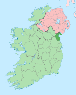 | |
| Villages and Townlands | ||
| ||