Earlton (Timiskaming Regional) Airport
| Earlton - Timiskaming Regional Airport | |||||||||||||||
|---|---|---|---|---|---|---|---|---|---|---|---|---|---|---|---|
 | |||||||||||||||
|
IATA: YXR – ICAO: CYXR – WMO: 71533 | |||||||||||||||
| Summary | |||||||||||||||
| Airport type | Public | ||||||||||||||
| Operator | Township of Armstrong | ||||||||||||||
| Location | Earlton, Ontario | ||||||||||||||
| Time zone | EST (UTC−05:00) | ||||||||||||||
| • Summer (DST) | EDT (UTC−04:00) | ||||||||||||||
| Elevation AMSL | 800 ft / 244 m | ||||||||||||||
| Coordinates | 47°41′42″N 079°50′56″W / 47.69500°N 79.84889°WCoordinates: 47°41′42″N 079°50′56″W / 47.69500°N 79.84889°W | ||||||||||||||
| Website |
www | ||||||||||||||
| Map | |||||||||||||||
 CYXR Location in Ontario | |||||||||||||||
| Runways | |||||||||||||||
| |||||||||||||||
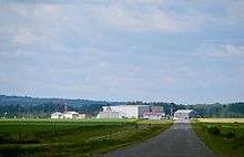
Earlton (Timiskaming Regional) Airport, (IATA: YXR, ICAO: CYXR), is located 1 nautical mile (1.9 km; 1.2 mi) southwest of Earlton, Ontario. The airport has a 5,998 by 150 ft (1,828 by 46 m) paved runway oriented east-west, and a 3,019 by 150 ft (920 by 46 m) gravel/snow runway oriented north-south.
References
- ↑ Canada Flight Supplement. Effective 0901Z 15 September 2016 to 0901Z 10 November 2016
- ↑ Synoptic/Metstat Station Information
External links
- Official website
- Page about this airport on COPA's Places to Fly airport directory
- Past three hours METARs, SPECI and current TAFs for Earlton (Timiskaming Regional) Airport from Nav Canada as available.
| By name | |
|---|---|
| By location indicator | |
| By province/territory | |
| By region | |
| National Airports System | |
| Related | |
| |
This article is issued from Wikipedia - version of the 12/4/2016. The text is available under the Creative Commons Attribution/Share Alike but additional terms may apply for the media files.