Eastern Finland Province
| Eastern Finland Itä-Suomen lääni Östra Finlands län | ||
|---|---|---|
| ||
 | ||
| Country | Finland | |
| Established | September 1, 1997 | |
| Abolished | January 1, 2010 | |
| Capital | Mikkeli | |
| Government | ||
| • Governor | Pirjo Ala-Kapee | |
| Area | ||
| • Total | 48,726 km2 (18,813 sq mi) | |
| Population (December 31, 2009) | ||
| • Total | 569,832 | |
| • Density | 12/km2 (30/sq mi) | |
| Time zone | EET (UTC+2) | |
| • Summer (DST) | EEST (UTC+3) | |
| ISO 3166 code | IS | |
| NUTS code | 13 | |
Eastern Finland was a province of Finland from 1997 to 2009. It bordered the provinces of Oulu, Western Finland and Southern Finland. It also bordered Russia to the east.
History
On September 1, 1997, the Mikkeli Province, the Kuopio Province and Northern Karelia Province were joined to form the new Eastern Finland Province.
All the provinces of Finland were abolished on January 1, 2010.[1]
Administration
The State Provincial Office was a joint regional authority of seven different ministries. It promoted national and regional objectives of the State central administration. Eastern Finland State Provincial Office had branch offices in Mikkeli, Joensuu, and Kuopio.
Regions
Eastern Finland was divided into three regions:
- North Karelia (Pohjois-Karjala / Norra Karelen)
- Northern Savonia (Pohjois-Savo / Norra Savolax)
- Southern Savonia (Etelä-Savo / Södra Savolax)
Municipalities in 2009 (cities in bold)
Eastern Finland was divided into 54 municipalities in 2009.
Former municipalities (disestablished before 2009)
|
|
Governors
- Pirjo Ala-Kapee 1997-2009
Heraldry
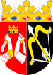
The coat of arms of Eastern Finland was composed of the arms of Savonia and Karelia.
Notes
- ↑ "New regional administration model abolishes provinces in 2010". Helsingin Sanomat International Edition. Sanoma Corporation. 31 December 2009. Retrieved 1 January 2010.
External links
- Eastern Finland State Provincial Office - Official site
- Video about travelling in Koli area
- Pielis.ru — По Восточной Финляндии и дальше ... (Russian)
Former provinces of Finland | ||
|---|---|---|
In parentheses are years when provinces were established and disestablished. | ||
| 1634–1775 |
| |
| 1775–1831 |
| |
| 1831–1918 | ||
| 1918–1997 |
| |
| 1997–2009 |
| |
Coordinates: 62°N 28°E / 62°N 28°E