Eastlakes, New South Wales
| Eastlakes Sydney, New South Wales | |||||||||||||
|---|---|---|---|---|---|---|---|---|---|---|---|---|---|
 Clubhouse, The Lakes Golf Club | |||||||||||||
| Coordinates | 33°55′54″S 151°12′37″E / 33.93167°S 151.21028°ECoordinates: 33°55′54″S 151°12′37″E / 33.93167°S 151.21028°E | ||||||||||||
| Population | 6,920 (2011 census)[1] | ||||||||||||
| • Density | 8,700/km2 (22,400/sq mi) | ||||||||||||
| Postcode(s) | 2018 | ||||||||||||
| Area | 0.8 km2 (0.3 sq mi) | ||||||||||||
| Location | 8 km (5 mi) south of Sydney CBD | ||||||||||||
| LGA(s) | Bayside Council | ||||||||||||
| State electorate(s) | |||||||||||||
| Federal Division(s) | Kingsford Smith | ||||||||||||
| |||||||||||||
Eastlakes is a suburb of Sydney, in the state of New South Wales, Australia. Eastlakes is located 8 kilometres south of the Sydney central business district, in the local government area of the Bayside Council, and is part of the Eastern Suburbs region. Eastlakes is mostly residential with a shopping centre located at Evans Avenue.
History
Eastlakes takes its name from the extensive lake system on its southeast and its location in the Eastern Suburbs. The area was once known as Botany Swamps. This was Sydney's third source of water when water was pumped from here to a reservoir in Paddington from 1859.[2]
The lakes were partly reclaimed from the swamp to create the Lakes Golf Course and Sydney Airport extensions. Part of the suburb is on the former site of the Rosebery Racecourse, which was redeveloped in the 1960s into a residential and commercial area.[3] Part of the racecourse area is now the site of a park with a memorial to local soldiers who trained on that site during both world wars.
Demographics
According to 2011 census, The most common ancestries in Eastlakes were Australian 10.5%, English 9.1%, Chinese 8.3%, Greek 6.9% and Bangladeshi 5.0%. 39.6% of people were born in Australia. The most common countries of birth were Bangladesh 6.2%, Indonesia 4.0%, China (excludes SARs and Taiwan) 3.7%, Greece 2.7% and Turkey 2.6%. 31.3% of people only spoke English at home. Other languages spoken at home included Bengali 7.8%, Greek 6.9%, Turkish 5.4%, Spanish 4.3% and Indonesian 4.2%. The most common responses for religion in Eastlakes (State Suburbs) were Catholic 26.0%, Islam 19.0%, Eastern Orthodox 11.5%, No Religion 10.1% and Anglican 6.0%.[1]
Schools
Eastlakes Public School began as an infants school in 1938 and was located in a church hall in O'Connor Street. It moved to Florence Avenue in 1944. When Rosebery Racecourse was demolished and the land developed as a residential area, enrolments at the school naturally increased and there was a need for a primary school, so Eastlakes included a primary school from 1979.[4]
Churches
The area is served by three churches as of 2009. A LDS Church is located in Mascot Drive. St Stephen's Anglican Church is located in Harry Street. Horner Memorial Hall, King Street, is a chapel in the Federation Carpenter Gothic style, which is used by Beckenham Memorial Uniting Church after relocating from their church after June 2015.
Sport and recreation
This area is home to several parks and golf courses. The Lakes Golf course and Eastlake Golf Course fall within the boundaries of the suburb of Eastlakes. Bonnie Doon Golf Course, Mutch Park and Astrolabe Park are located in the adjacent suburb of Pagewood.
Gallery
 Eastlakes Public School, Florence Avenue
 Horner Memorial Hall, King Street
 St Stephen's Anglican Church, Harry Street
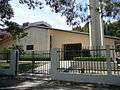 LDS Church, Mascot Drive
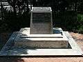 War memorial on former racecourse site, Florence Avenue
 Weatherboard cottage, King Street
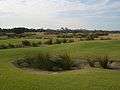 Eastlake Golf Course
References
- 1 2 Australian Bureau of Statistics (31 October 2012). "Eastlakes (State Suburb)". 2011 Census QuickStats. Retrieved 1 May 2013.
- ↑ "Botany Wetlands". Sydney Water Heritage Item. Sydney Water. Retrieved 27 March 2016.
- ↑ The Book of Sydney Suburbs, Frances Pollon, Angus & Robertson Publishers, 1990, ISBN 0-207-14495-8, p.91
- ↑ Eastlakes Public School
External links
| Wikimedia Commons has media related to Eastlakes, New South Wales. |