Egnatia, Ioannina
For other uses, see Egnatia (disambiguation).
| Egnatia Εγνατία | |
|---|---|
 Egnatia | |
|
Location within the regional unit 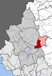 | |
| Coordinates: 39°44′N 21°04′E / 39.733°N 21.067°ECoordinates: 39°44′N 21°04′E / 39.733°N 21.067°E | |
| Country | Greece |
| Administrative region | Epirus |
| Regional unit | Ioannina |
| Municipality | Metsovo |
| • Municipal unit | 131.424 km2 (50.743 sq mi) |
| Elevation | 819 m (2,687 ft) |
| Population (2011)[1] | |
| • Municipal unit | 2,331 |
| • Municipal unit density | 18/km2 (46/sq mi) |
| Time zone | EET (UTC+2) |
| • Summer (DST) | EEST (UTC+3) |
| Vehicle registration | ΙΝ |
Egnatia (Greek: Εγνατία) is a former municipality in the Ioannina regional unit, Epirus, Greece. Since the 2011 local government reform it is part of the municipality Metsovo, of which it is a municipal unit.[2] The municipal unit has an area of 131.424 km2.[3] In 2011 its population was 2,331. The seat of the municipality was in Mikro Peristeri. The municipal unit is connected with both the GR-6/E92 (Larissa - Ioannina - Igoumenitsa) and the new Via Egnatia.
Subdivisions
The municipal unit Egnatia is subdivided into the following communities (constituent villages in brackets):
- Chrysovitsa (Chrysovitsa, Ampelia, Analipsi, Myloi, Xiriko, Siolades)
- Megali Gotista (Megali Gotista, Baltouma)
- Mega Peristeri (Mega Peristeri, Ampelakia, Karyofyto, Kastri, Kerasia, Milies)
- Mikra Gotista (Mikra Gotista, Agios Minas, Batza, Riza, Sioutsos)
- Mikro Peristeri (Mikro Peristeri, Giarakari, Neo Gerakari, Palaiochori, Prosilia, Rachoula, Tampouria)
- Sitsaina
References
- ↑ "Απογραφή Πληθυσμού - Κατοικιών 2011. ΜΟΝΙΜΟΣ Πληθυσμός" (in Greek). Hellenic Statistical Authority.
- ↑ Kallikratis law Greece Ministry of Interior (Greek)
- ↑ "Population & housing census 2001 (incl. area and average elevation)" (PDF) (in Greek). National Statistical Service of Greece.
 |
East Zagori | Metsovo | | |
| East Zagori | |
Metsovo | ||
| ||||
| | ||||
| Perama | Pamvotida, Syrrako | Aspropotamos |
This article is issued from Wikipedia - version of the 12/1/2016. The text is available under the Creative Commons Attribution/Share Alike but additional terms may apply for the media files.